Florida State Road 686
| ||||
|---|---|---|---|---|
| East Bay Drive, Roosevelt Boulevard | ||||
| Route information | ||||
| Maintained by FDOT | ||||
| Length | 10.823 mi[1] (17.418 km) | |||
| Major junctions | ||||
| West end |
| |||
| East end |
| |||
| Highway system | ||||
| ||||

State Road 686 (SR 686) is an east–west route in Pinellas County, running from Alt US 19 in Largo east to an intersection with State Road 687 (4th Street) and State Road 694 (Gandy Boulevard) in St. Petersburg, Florida.
Route description
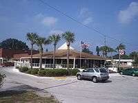
State Road 686 begins at Alt US 19, running east as East Bay Drive. It runs through Largo, where it crosses an interchange with US 19 and east of the intersection, SR 686 is known as Roosevelt Boulevard, named for President Franklin Delano Roosevelt. It then travels in a southeastern direction through Clearwater, and intersects State Road 688 (Ulmerton Road), and heads east with a concurrency for just under a mile. At the end of the concurrency, SR 686 once again heads southeast, entering St. Petersburg. An interchange with Interstate 275 follows, and SR 686 ends at the intersection with SR 687 (4th Street) and SR 694 (Gandy Boulevard).
History
Originally, SR 686 extended further west, ending at Gulf Boulevard in Belleair Beach, next to the shores of the Gulf of Mexico.
Major intersections
The entire route is in Pinellas County.
| Location | mi[1] | km | Destinations | Notes | |
|---|---|---|---|---|---|
| Largo | 0.000 | 0.000 | Western terminus | ||
| 0.789 | 1.270 | Highland Avenue (CR 375 north) | |||
| 1.157 | 1.862 | Alternate Keene Road (CR 395 north) | |||
| 1.548 | 2.491 | ||||
| 2.567 | 4.131 | Belcher Road (CR 501) | |||
| 3.55 | 5.71 | interchange | |||
| 4.061 | 6.536 | 62nd Street North (CR 565 south) | |||
| 4.732 | 7.615 | Avalon Avenue (CR 595 south) | |||
| 5.46 | 8.79 | interchange | |||
| | 6.079 | 9.783 | St. Petersburg-Clearwater International Airport | ||
| Pinellas Park | 6.903 | 11.109 | interchange; west end of SR 688 overlap; no access from SR 688 east to SR 686 west | ||
| St. Petersburg | 7.867 | 12.661 | interchange; east end of SR 688 overlap | ||
| Pinellas Park–St. Petersburg line | 8.503 | 13.684 | 28th Street North (CR 683 south) | ||
| St. Petersburg | 9.31 | 14.98 | Exit 30 (I-275) | ||
| 10.272 | 16.531 | ||||
| 10.823 | 17.418 | Eastern terminus | |||
1.000 mi = 1.609 km; 1.000 km = 0.621 mi
| |||||
State Road 686A
| |
|---|---|
| Location | St. Petersburg |
| Length | 1.439 mi[2] (2.316 km) |
State Road 686A is an under construction state road in St. Petersburg. The route is being constructed along what is currently Pinellas County Road 296, consisting of 118th Avenue North and the 118th Avenue Connector, as part of the Gateway Expressway.
As of August 2018, the route is 1.439 miles long, and is planned for 4 miles in length. The route currently runs from the foot of the 118th Avenue Connector westbound offramp (milepost 1.582) to just east of the I-275 on-ramps (milepost 3.021).
County Road 416
| |
|---|---|
| Location | Largo |
| Length | 3.00 mi[3] (4.83 km) |
County Road 416 extends from Gulf Boulevard in Belleair Beach, east to Clearwater-Largo Road in Largo. The entirety of the route was previously signed as SR 686.
From Gulf Boulevard in Belleair Beach, through Belleair Bluffs to Indian Rocks Road, the road is called the Belleair Causeway. In Largo, it becomes West Bay Drive. West Bay Drive is historically Largo's "Main Street".
References
- 1 2 FDOT straight line diagrams Archived March 6, 2014, at the Wayback Machine., accessed March 2014
- ↑
- ↑ "Archived copy" (PDF). Archived from the original (PDF) on 2007-01-12. Retrieved 2011-02-22. FDOT Federal-Aid Report
Further reading
Largo Area Historical Society. From Pines and Palmettos—A portrait of Largo. The Donning Company Publishers. Virginia Beach, Va. 2005.
Largo Bicentennial Book Committee. Largo, then till . . . . Largo Area Historical Society. 1979.
Pinellas County Staff. Pinellas County GIS Viewer. Online May 6, 2006.