Texas State Highway 37
| ||||
|---|---|---|---|---|
 | ||||
| Route information | ||||
| Maintained by TxDOT | ||||
| Length | 92.3 mi[1] (148.5 km) | |||
| Existed | 1939–present | |||
| Major junctions | ||||
| South end |
| |||
|
| ||||
| North end |
| |||
| Highway system | ||||
| ||||

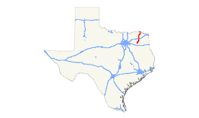
State Highway 37 is a state highway that runs from the Oklahoma border near Albion to Mineola in the northeast corner of the state.
History

SH 37 was designated as a route on April 13, 1918 from Clarksville to Lufkin.[2] On August 21, 1923, it was pared back, with everything north of Mt. Vernon either cancelled or transferred to the new SH 66, and the portion from Jacksonville to Lufkin transferred to SH 40. On May 23, 1927, it was extended north to Talco.[3] On June 24, 1931, it was extended north to the Oklahoma border, replacing SH 66.[4] On July 15, 1935, everything north of Clarksville was cancelled.[5] The section north of Clarksville was restored on December 20, 1937.[6] On June 26, 1939, the stretch from Mineola to Tyler was transferred to U.S. Highway 69 (Cosigned with since 1934), with the remaining route continuing to the present.
SH 37A was designated on January 19, 1920 as a spur from Tyler to Troup.[7] This was cancelled on November 27, 1922.[8] SH 37A was restored on February 18, 1924.[9] It was cancelled by 1929. SH 37A was designated on April 23, 1929 from Quitman to Sulphur Springs.[10] This was renumbered to SH 154 on March 19, 1930.
Junction list
| County | Location | mi | km | Destinations | Notes |
|---|---|---|---|---|---|
| Wood | Mineola | Southern terminus | |||
| | |||||
| Quitman | |||||
| South end of SH 154 overlap; western terminus of SH 182 | |||||
| North end of SH 154 overlap | |||||
| | |||||
| Winnsboro | |||||
| Franklin | | ||||
| | |||||
| | |||||
| Mount Vernon | |||||
| | |||||
| | |||||
| Red River | | ||||
| Bogata | |||||
| | |||||
| | |||||
| | |||||
| Clarksville | |||||
| | |||||
| | |||||
| | |||||
| | |||||
| | |||||
| Albion | Continuation into Oklahoma | ||||
1.000 mi = 1.609 km; 1.000 km = 0.621 mi
| |||||
References
- ↑ Transportation Planning and Programming Division (n.d.). "State Highway No. 37". Highway Designation Files. Texas Department of Transportation.
- ↑ (PDF) https://publicdocs.txdot.gov/minord/MinuteOrderDocLib/003676759.pdf. Missing or empty
|title=(help) - ↑ (PDF) https://publicdocs.txdot.gov/minord/MinuteOrderDocLib/003676976.pdf. Missing or empty
|title=(help) - ↑ (PDF) https://publicdocs.txdot.gov/minord/MinuteOrderDocLib/003673804.pdf. Missing or empty
|title=(help) - ↑ (PDF) https://publicdocs.txdot.gov/minord/MinuteOrderDocLib/003673871.pdf. Missing or empty
|title=(help) - ↑ (PDF) https://publicdocs.txdot.gov/minord/MinuteOrderDocLib/003673912.pdf. Missing or empty
|title=(help) - ↑ (PDF) https://publicdocs.txdot.gov/minord/MinuteOrderDocLib/003676818.pdf. Missing or empty
|title=(help) - ↑ (PDF) https://publicdocs.txdot.gov/minord/MinuteOrderDocLib/003676869.pdf. Missing or empty
|title=(help) - ↑ (PDF) https://publicdocs.txdot.gov/minord/MinuteOrderDocLib/003676884.pdf. Missing or empty
|title=(help) - ↑ (PDF) https://publicdocs.txdot.gov/minord/MinuteOrderDocLib/003673782.pdf. Missing or empty
|title=(help)