Stankovany
| Stankovany | |
| Village | |
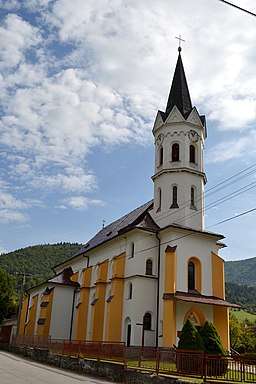 Church | |
| Country | Slovakia |
|---|---|
| Region | Žilina |
| District | Ružomberok |
| Elevation | 649 m (2,129 ft) |
| Coordinates | 49°09′N 19°11′E / 49.150°N 19.183°ECoordinates: 49°09′N 19°11′E / 49.150°N 19.183°E |
| Area | 12.797 km2 (4.94 sq mi) |
| Population | 770 |
| Density | 60/km2 (155/sq mi) |
| First mentioned | 1322 |
| Postal code | 034 92 |
| Area code | +421-44 |
| Car plate | RK |
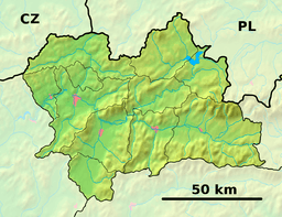 Location of Stankovany in the Žilina Region  Stankovany (Slovakia) | |
| Wikimedia Commons: Stankovany | |
| Website: www.stankovany.sk/ | |
Valaská Dubová is a village and municipality in Ružomberok District in the Žilina Region of northern Slovakia.
History
In historical records the village was first mentioned in 1322.
Geography
The municipality lies at an altitude of 649 metres and covers an area of 12.797 km². It has a population of about 770 people.
External links
Municipalities of Ružomberok District | ||
|---|---|---|
This article is issued from
Wikipedia.
The text is licensed under Creative Commons - Attribution - Sharealike.
Additional terms may apply for the media files.