Mairangi Bay
| Mairangi Bay | |
|---|---|
| Basic information | |
| Local authority | Auckland Council |
| Population | 5,277 (2006) |
| Surrounds | |
| North | Murrays Bay |
| Northeast | (Hauraki Gulf) |
| East | (Hauraki Gulf) |
| Southeast | Campbells Bay |
| South | Campbells Bay |
| Southwest | Sunset North |
| West | Windsor Park |
| Northwest | Pinehill |
Mairangi Bay is a coastal suburb of North Shore, Auckland, located in the northern North Island of New Zealand, on the south-east-facing peninsula forming the northern side of the Waitematā Harbour. Mairangi Bay came under the local governance of the North Shore City Council until subsumed into the Auckland Council in 2010. The population was 5,277 in the 2006 census, an increase of 501 from 2001.[1]
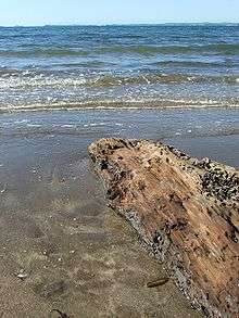
The Bay's beach itself has, along with adjacent Murrays and Campbells Bays, undergone civil works projects since 2004 to improve stormwater management.[2]
Education
Mairangi Bay School and St John's School are coeducational contributing primary (years 1-6) schools with decile ratings of 10 and rolls of 403[3] and 315,[4] respectively. Mairangi Bay School was founded in 1967.[5] St John's is a state integrated Catholic School, which was founded in 1961.[6]
Rangitoto College is a large secondary school in Windsor Park, to the west of Mairangi Bay.
References
- ↑ Quickstats about Mairangi Bay
- ↑ Works & Environment Committee, North Shore City Council, 3 December 2002 Archived 28 September 2007 at the Wayback Machine.
- ↑ Te Kete Ipurangi schools database: Mairangi Bay School
- ↑ Te Kete Ipurangi schools database: St Johns School
- ↑ "Mairangi Bay Case Study 2" (PDF). Edtech Limited. Archived from the original (PDF) on 14 October 2008. Retrieved 2009-01-24.
- ↑ "A History of Development". St John's School. Archived from the original on 14 October 2008. Retrieved 2009-01-24.
External links
- Mairangi Bay School website
- St Johns School website
- Photographs of Mairangi Bay held in Auckland Libraries' heritage collections.
Coordinates: 36°44′19″S 174°44′54″E / 36.73861°S 174.74833°E