St Aidan's
| RSPB St Aidan's | |
| Nature reserve | |
| Country | England |
|---|---|
| County | West Yorkshire |
| River | River Aire |
| Coordinates | 53°44′56″N 1°24′31″W / 53.749015°N 1.408653°WCoordinates: 53°44′56″N 1°24′31″W / 53.749015°N 1.408653°W |
| Founded | 2017 |
| Management | Royal Society for the Protection of Birds |
| Owner | Leeds City Council |
| For public | Daily (except Christmas Day) |
 | |
St Aidan's is a 400 hectare Country Park between Leeds and Castleford[1] in West Yorkshire, England. The land was formerly an opencast coal mining area that was flooded after the riverbank collapsed. Repairs and remediation required its own act in Parliament to allow the necessary works to go ahead.[2] Mining ceased at St Aidan's in 2002.[3]
The Country Park opened to the public in May 2013 under the care of the Royal Society for the Protection of Birds (RSPB). However, the car park and visitor centre were subsequently closed in July 2013 due to unresolved land issues.[4][5] With the successful transfer of St Aidan's to Leeds City Council, a 99-year lease was signed from the council to the RSPB in March 2017. The site is now open and functioning as an RSPB reserve. It is open every day excluding Christmas Day with the visitor centre open from 9am to 5pm February – October and 9am to 4pm November – January.[6]
RSPB St Aidan's Nature Park is designed for both people and wildlife and is open for a wide range of activities, from bird watching, cycling and walking to jogging, horse riding and dog walking.
History
St Aidan's Country Park comprises the former St Aidan's opencast site, Lowther North opencast site and parts of the former Savile Colliery, Methley.[7] In March 1988, there was a slope failure on the banks of the River Aire, resulting in a massive flood of 17,000,000 l (3,700,000 imp gal; 4,500,000 US gal) of water.[8] Mining operations were suspended and remedial works costing £20 million were required to drain the site and re-route the river.[9] The resultant deluge created a lake that was 100 ha (250 acres) in size and 70 m (230 ft) deep.[10] RAF Chinook helicopters were used to ferry sandbags into the breach, but it did not stop the water cascading in. Not only did the downstream river flow into the site, but the River Calder actually flowed upstream in the River Aire waterbed from Castleford until the water found a natural level.[11] Government documentation states that it was the Aire and Calder Navigation, whilst others list the Aire as being the source of the water that flooded St Aidan's. The failure came about just south east of Lemonroyd Lock[12] where the two waterways converge. Mining was subsequently completed and then the site was converted into a wetland.
The Pontefract and District Archaeological Society won the Pitt Rivers award for their work on the preservation of the ships and heritage that was found in the abandoned river bed after the water was diverted. The find provided a unique insight into river trade in the seventeenth century onwards, including the hulls of four boats (virtually intact), various pottery and evidence of a medieval weir.[13][14]
Ownership of the land was transferred in 2010 from UK Coal/Harworth Estates to St Aidan's Trust, a charity administered by Leeds City Council. The trust would then lease the land to the RSPB for 99 years on a peppercorn rent.[15] The Country Park officially opened to the public on 25 May 2013. Unfortunately, due to unresolved land ownership issues, the RSPB withdrew its staffing and support in July 2013.[4] As of 21 December 2016 ownership of St Aidan's was successfully passed from Harworth Estates to the St Aidan's Trust (of which Leeds city council is the sole trustee). RSPB were then given confirmation that the site would be leased to them on a 99-year lease in March 2017. The site was reopened in April 2017 and RSPB now have control of the management of the site and the reopening of the car park, visitor centre and visitor operations.
Location
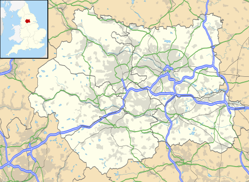
St Aidan's is adjacent to the River Aire and the Aire and Calder Navigation. The reserve can be accessed via a network of paths, some of which run alongside the River Aire. It is approximately 2 miles from Woodlesford railway station. Nearby are the residential areas of Allerton Bywater, Mickletown, Methley, Woodlesford, Swillington and Great Preston, all of which lie within an area bounded by three motorways: A1(M), M62 and M1.
Wildlife
The main trails at St Aidan's take you amongst a variety of habitats including reedbed, wetland, meadows and woodland.[16] St Aidan's is home to many species of bird including the Eurasian bittern, little owl, western marsh harrier, and Eurasian skylark.[17] Breeding birds on the reserve include one of the rarest in the UK, black-necked grebe with around 25% of the national population which nest, for protection, near the one-thousand pairs of black-headed gull. Northern lapwing and common redshank also breed.[18]
Dragline

There is a dragline known as "Oddball" at St Aidan's. Oddball, whose name refers to it having been built in the US to run on a 60 Hz electrical supply rather than the UK standard 50 Hz,[19][20] was brought to K from the US in 1946 and weighs 1220 tons.[8][21] The group Friends of St. Aidan's BE1150 Dragline claim that it is the largest preserved walking dragline excavator in Western Europe. The excavator was originally christened Clinchfield and was used to surface mine coal from the area now occupied by St Aidan's Country Park.[22]
The group hold 'open days' throughout the year where visitors can look around the machine and sit in the cab.[23]
References
- ↑ "St Aidan's becomes a new RSPB Nature Park". Harworth Estates. Retrieved 24 November 2015.
- ↑ "Aire and Calder Navigation Act 1992" (PDF). Legislation. HM Gov. 16 March 1992. Retrieved 24 November 2015.
- ↑ "New face in the Lower Aire Valley". RSPB. RSPB. 1 April 2008. Retrieved 24 November 2015.
- 1 2 "RSPB temporarily closes St Aidan's visitor centre". RSPB. RSPB. 12 July 2013. Retrieved 24 November 2015.
- ↑ Bellamy, Allison (22 April 2014). "Leeds nature reserve in legal limbo after land ownership row". Yorkshire Evening Post. Retrieved 24 November 2015.
- ↑ https://www.rspb.org.uk/reserves-and-events/reserves-a-z/st-aidans/
- ↑ "Lease of the St.Aidan's Trust Land to the Royal Society for the Protection of" (PDF). LCC. Leeds City Council. 25 August 2010. p. 2. Retrieved 24 November 2015.
- 1 2 Oliver, Stuart (5 September 2001). "A day out...to a coal mine" (PDF). UK Coal. Hsprod.investis. Retrieved 24 November 2015.
- ↑ Hughes, D B (2001). "The River Aire slope failure at the St. Aidans Extension Opencast Coal Site, West Yorkshire, United Kingdom". Canadian Geotechnical Journal. Retrieved 24 November 2015.
- ↑ "Aire and Calder Navigation". Graces Guide to British Industrial History. Retrieved 24 November 2015.
- ↑ "The Swillington Story". Wild West Yorkshire Nature Diary. 17 April 2000. Retrieved 24 November 2015.
- ↑ "Lemonroyd Lock". Canal Plan. Retrieved 24 November 2015.
- ↑ "British Archaeological Awards 2000". Archaeological Awards. 16 November 2000. Retrieved 24 November 2015.
- ↑ Houlder, Eric (1997). "The Saint Aidan's Project" (PDF). Pontarch Newsletter (35): 1. Retrieved 24 November 2015.
- ↑ "Lease of the St.Aidan's Trust Land to the Royal Society for the Protection of" (PDF). Democracy LCC. Leeds City Council. 25 August 2010. p. 9. Retrieved 24 November 2015.
- ↑ "St Aidan's". RSPB. Retrieved 26 June 2018.
- ↑ "RSPB to open major new site for people and wildlife in Yorkshire". Bird Guides. 24 May 2013. Retrieved 24 November 2015.
- ↑ Granger, Sally (Spring 2018). "Behind The Scenes. St Aiden's". Nature's Home. RSPB. p. 74–76.
- ↑ "Oddball Dragline, St. Aidan's Opencast Mine". DerelictPlaces. Retrieved 21 January 2016.
- ↑ "Oddball's big future as part of former miners' Leeds park plan". Yorkshire Evening Post. 28 December 2012. Retrieved 24 November 2015.
- ↑ "St Aidan's nature reserve opens at former mine". BBC. 23 May 2013. Retrieved 24 November 2015.
- ↑ "About Us". Friends of St Aidan's BE1150 Walking Dragline. Retrieved 24 November 2015.
- ↑ "News and Events". Friends of St Aidans BE1150 Walking Dragline. Retrieved 24 November 2015.
External links
- RSPB: St Aidans
- Guardian: Former Leeds opencast mine will become country's largest wetland area
- The River Aire slope failure at the St. Aidans Extension Opencast Coal Site, West Yorkshire, United Kingdom
- St Aidan's Trust Annual Report and accounts 2008
- Derelict places - Oddball dragline
- Friends of St Aidan's Dragline at IA Recordings
- Friends of St Aidans official site