St. Michael's School, Kannur
| St. Michael’s School, Kannur | |
|---|---|
 | |
| Location | |
| Kannur, Kerala, India | |
| Information | |
| Type | Jesuit, Catholic |
| Denomination | All faiths |
| Established | 1865 |
| Rector | Domic Madathaniyil, SJ |
| Principal | John Francis, SJ |
| Headmaster | Gracious, SJ[1] |
| Staff | 85 teachers |
| Gender | Coeducational |
| Enrollment | 2,000 |
| Website | StMichaelKannur |
 | |
St. Michael’s School, Kannur, India, was founded by the Christian Brothers in 1865 and administered by the Society of Jesus since 1887. It admits all castes and creeds but gives preference to Catholics. It includes nursery through higher secondary[2]and prepares students for the CBSE exams.[3]
History
St. Michaels is the oldest and one of the best schools in the city.[4] Oral tradition tells of St Michael’s roots in a Malayalam-medium school attached to Holy Trinity Church, Kannur in the late 1850s. The Christian Brothers came in 1862, introduced English, and erected a new building in 1865, from which its present history is now traced. When these Brothers departed in 1887 the Jesuit priests who ran the parish took over the school. In 1907 the Jesuits made it a European-style middle school, and in 1936 a high school under the Anglo-Indian code. In 1974, for need of financial assistance, the school came under the Kerala Education Rules,[5] as an Anglo-Indian Higher Secondary School.
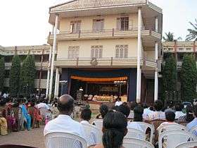
Noise from a nearby textile mill in Burnacherry caused efforts to relocate over a period of years. The new campus somewhat to the north was purchased gradually, with the Coelho Building going up in 1956. A Jesuit residence at the present location was built in 1973. The PTA helped build a mini-stadium in 1994 and the first stage of the present block was built in 1996, with the higher secondary building added in 2000. The central block with a stage on the ground floor and offices on the first floor opened in 2000. Soon after, the new Jesuit residence and St. Michael’s statue were added.[6]
St. Michael's has been ranked among the best schools in India.[7]
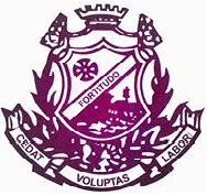
Crest
The school crest has a cross over a shield encircled by laurels. The crown signifies the sovereignty of St. Michael the Archangel. Fortitude is a cardinal virtue and the fort signifies security in life that we find in the cross, our victory over difficulties. The wreath of laurels signifies St. Michael's conquest over all evil. "Cedat Voluptas Labori" reminds us that our search for pleasure should yield to hard work.[7]
Facilities
Facilities include two computer labs with 45 computers,[8] along with laboratories for chemistry, physics, zoology, and botany. The audio-visual room seats 300. There are special rooms for music and for arts.[9] The two libraries together hold fourteen thousand books. There are four staff rooms. An auditorium is under construction.[6]
Activities
Clubs and organizations
Clubs cover the areas of arts, health, science, math, environmentalism,[10] tourism, media, philately, interactivity, karate, language, police, and quizzes.[11]
The school has an active alumni club which has an annual reunion at the school.[12]
Sports
Sports sponsored by the school include track, football, cricket, table tennis, basketball, volleyball, wrestling, and martial arts.[9]
Publications
Publications include an annual with news of activities of the year along with student literary works. A second magazine Mozhi carries creative writings by the students.[13]
Empowerment programmes
Student empowerment programmes are devised to give students more self-confidence. All students attend a life guidance and leadership camp between the ninth and tenth grades. Some clubs and organizations also conduct their own camps.[14] Remedial coaching and tutorials are conducted for students who need help.
In an outreach programme, students are taken to homes for the elderly and to orphanages, to foster a sense of compassion.[15]
Two or three times a year all students are involved in an eco-awareness programme, during which they clean up the campus and plant trees.[16]
Jesuit scholars and educators from outside the school hold in-service sessions for teachers, as well as an orientation programme for new teachers.[14]
References
- ↑ Staff. Retrieved 18 December 2016
- ↑ "www.stmichaelskannur.com | St.Michaels Anglo Indian Boys Higher Secondary School Kannur | St Michael's Nursery School Kannur, Kerala". stmichaelskannur.com. Retrieved 2017-08-27.
- ↑ "Cbseresults.nic.in CBSE 12th Result 2017 declared at Cbse.nic.in: How to Check via SMS, Websites and School Name Wise". www.sslcresult2017.co.in. Retrieved 2017-08-28.
- ↑ "indian - GPS Places and POI in India (English language)". geodeg.com. Retrieved 2017-08-28.
- ↑ The Kerala Education Act, 1958.
- 1 2 "www.stmichaelskannur.com History of St. Michael's School Kannur, Kerala". stmichaelskannur.com. Retrieved 2016-12-18.
- 1 2 "Education for Childrens: Best Schools in India". Education for Childrens. Retrieved 2017-08-28.
- ↑ "St Michael'S Anglo Indian Hss, Kannur School, Kannur 2, Kannur - Kerala". iCBSE. Retrieved 2017-08-27.
- 1 2 Reporter, Staff. "The Hindu-Young World Painting Competition: Strokes that spoke and won". The Hindu. Retrieved 2016-12-18.
- ↑ assets.wwfindia.org/downloads/mruthika__jan_feb_2008.pdf
- ↑ "www.stmichaelskannur.com Club Activities of St.Michael's School Kannur, Kerala". stmichaelskannur.com. Retrieved 2016-12-18.
- ↑ "St Michael'S Anglo Indian Hss, Kannur School, Kannur 2, Kannur - Kerala". iCBSE. Retrieved 2017-08-28.
- ↑ "www.stmichaelskannur.com Publications of St.Michael's Kannur, Kerala". stmichaelskannur.com. Retrieved 2016-12-18.
- 1 2 "www.stmichaelskannur.com Students & Staff Empowerment Programmes St.Michael's School Kannur". stmichaelskannur.com. Retrieved 2016-12-18.
- ↑ "www.stmichaelskannur.com Our Outreach Programme St.Michael's Kannur, Kerala". stmichaelskannur.com. Retrieved 2016-12-18.
- ↑ "GLOBE India, GLOBE Programme in India - A Complete Learning Educationally Meaningful Programme for the purpose of generating knowledge about the environment". globeindia.org. Retrieved 2016-12-18.
Coordinates: 11°51′55.96″N 75°21′52.06″E / 11.8655444°N 75.3644611°E