St. Martin's Island
| Native name: Narikel jinjira (Bengali) Daruchini Dwip (Bengali) | |
|---|---|
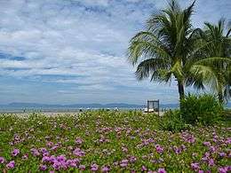 A view of the coastal area | |
| Geography | |
| Location | Bay of Bengal |
| Coordinates | 20°36′47″N 92°19′36″E / 20.61306°N 92.32667°ECoordinates: 20°36′47″N 92°19′36″E / 20.61306°N 92.32667°E |
| Area | 8 km2 (3.1 sq mi) |
| Length | 6 km (3.7 mi) |
| Width | 0.5 km (0.31 mi) |
| Administration | |
| Demographics | |
| Population | 4,000 |
|
| |
 Bangladesh | |
| Location |
St. Martin's Island Bay of Bengal Bangladesh |
|---|---|
| Coordinates | 20°37′58″N 92°19′12″E / 20.632722°N 92.320056°E |
| Year first constructed | n/a |
| Foundation | concrete base |
| Construction | metal skeletal tower[1] |
| Tower shape | square pyramidal skeletal tower with balcony and lantern[1] |
| Markings / pattern | white and red horizontal bands, white and red horizontal daymark on the top[1] |
| Height | 35 metres (115 ft)[1] |
| Focal height | 39 metres (128 ft)[2] |
| Range | 20 nautical miles (37 km; 23 mi)[2] |
| Characteristic | Fl W 37s.[2] |
| Racon | M[2] |
| Admiralty number | F1057 [2] |
| NGA number | 26752 [2] |
| ARLHS number | BAN-006 Bangladesh Department of Shipping[1] |


St. Martin's Island (Bengali: সেন্ট মার্টিন্স দ্বীপ) is a small island (area only 8 km2) in the northeastern part of the Bay of Bengal, about 9 km south of the tip of the Cox's Bazar-Teknaf peninsula, and forming the southernmost part of Bangladesh. There is a small adjoining island that is separated at high tide, called Chera Dwip. It is about 8 kilometres (5 miles) west of the northwest coast of Myanmar, at the mouth of the Naf River.
The first settlement started 250 years ago by Arabian sailors who named the island 'Jazeera'. During British occupation the island was named St. Martin Island. During the First Anglo-Burmese War between the British and Burmese empires in 1824–1826, rival claims to the island were a major factor. The local names of the island are "Narikel jinjira"[3] which means 'Coconut Island' in Bengali, and "Daruchini Dwip" which means "Cinnamon island" in Bengali. It is the only coral island in Bangladesh.It is also the southernmost part among Extreme Points of Bangladesh
Inhabitants
Most of the island's approximately 3,700[4] inhabitants live primarily from fishing. The other staple crops are rice and coconut. Being very common on the island, algae are collected, dried, and exported to Myanmar. Between October and April, the fishermen from neighboring areas bring their caught fishes to the island's temporary wholesale market. However, imports of chicken, meat and other foods come in from the mainland Bangladesh and Myanmar (Burma). As the centre and the south are mainly farmland and makeshift huts, most of the permanent structures are around the far north.
During the rainy season, because of the dangerous conditions on the Bay of Bengal, the inhabitants have no scope to go to the mainland (Teknaf) and their life can become dangerous. There is a hospital on the island, but in the past there has often been no doctor.

Transportation
The only way to reach St. Martin's Island is by water transportation: boats and ships (mostly for tourists) from Teknaf. The only internal transport for island is non motorized van (pulled by man.) The roads are made of concrete, and their condition are decent. All the hotels run generators until 11 PM which are not allowed afterwards, so they then rely on solar power, which is popular throughout the island. There is no electricity supply from the national grid since a hurricane in 1991. The island is all about sun, sea and palm trees. During the day, it comes alive with water and beach sports, with beach parties and bonfires lighting up the evening skies.


Tourism
From 1989 to 2004, non-residential Bangladeshis and foreigners were the only people permitted on the island; however, this has changed and now residential Bangladeshis are allowed. St. Martin's Island has become a popular tourist spot. Five shipping liners run daily trips to the island, including Shahid Sher Niabat, L C T Kutubdia, Eagle, Keari Cruise & Dine, and Keari-Sindbad. Tourists can book their trip either from Chittagong or from Cox's Bazar. The surrounding coral reef has an extension named Chera Dwip. A small bush is there, which is the only green part, enhancing the beauty of this island. People do not live on this part, so it is advisable for the tourists to go there early and come back by afternoon.
In the past five years St. Martin's visitor population has increased dramatically. While this situation has proven to be lucrative for the islanders, it is causing the natural beauty to deteriorate. Presently there are many efforts being put forth to preserve the several endangered species of turtles that nest on the island, as well as the corals, some of which are found only on Narikel Jinjira. Pieces of the coral reef are being removed to be sold to tourists.[5] Nesting turtles are sometimes taken for food, and their hatchlings are often distracted by the twinkling lights along the beach. Fish, a few recently discovered, are being overfished. Every year the fishermen must venture further out to sea to get their catch. Most of them use motorless boats.
It is possible to walk around the island in a day because it measures only 8 km2 (3 sq. mile), shrinking to about 5 km2 (2 sq. mi) during high tide. The island exists only because of its coral base, so removal of that coral risks erosion of the beach. Because of this, St. Martin's has lost roughly 25% of its coral reef in the past seven years.
Shootings of St. Martin's fishermen


Fishing is one of largest professional activities of St. Martin's Island's 5,500 residents; however, territorial disputes between Myanmar and Bangladesh have resulted in a state of tension between the countries that can erupt into violence, often targeting unarmed Bangladeshi fishermen. Below is a brief summary of shooting incidents against St. Martin's fishermen:
- On October 7, 1998 between three and five Bangladeshi fishermen were killed by Burmese Navy forces just off the coast of St. Martin's Island.[6]
- On September 8, 1999 one Bangladeshi fisherman was shot and killed by Burmese Navy forces near St. Martin's Island. Nine crewmen from the victim's fishing boat abandoned it, swam for their lives, and were rescued by Bangladeshi forces. The Bangladeshi government lodged a formal protest note to Myanmar.[7]
 'Keari Sindbad'an advanced sea-going vessel with modern facilities for tourists
 - On August 20, 2000 the Bangladeshi police reported that Burmese border guards had shot and killed four Bangladeshi fishermen off the coast of St. Martin's Island.[8]
- In 2011 pirates attacked fishermen 5 km off the coast of St. Martin's Island and killed four of them.[9]
Climate and weather
The best weather is usually between November and February; this is the major tourist season. Between March and July, cyclones can strike. The island was devastated by a cyclone in 1991 but has fully recovered, and was untouched by the 2004 tsunami. Thus, March to July is off-season for tourists.
See also
References
- 1 2 3 4 5 "Bangladesh". The Lighthouse Directory. University of North Carolina at Chapel Hill. Retrieved 30 May 2017.
- 1 2 3 4 5 6 List of Lights, Pub. 112: Western Pacific and Indian Oceans Including the Persian Gulf and Red Sea (PDF). List of Lights. United States National Geospatial-Intelligence Agency. 2016.
- ↑ "Saint Martin Island Bangladesh". Abdul Aouwal. May 3, 2016. Retrieved 2016-06-25.
- ↑ Chowdhury, Sifatul Quader (2012). "St Martin's Island". In Islam, Sirajul; Jamal, Ahmed A. Banglapedia: National Encyclopedia of Bangladesh (Second ed.). Asiatic Society of Bangladesh.
- ↑ "Tourists discover Saint Martin island". eTurbo News. February 19, 2008. Retrieved 2009-01-19.
- ↑ Myanmar Guards Kill Two Bangladeshis, October 8, 1998, Reuters
- ↑ Myanmar border guards kill Bangladeshi fisherman, September 8, 1999, Reuters
- ↑ Reuters, August 20, 2000
- ↑ http://newagebd.com/newspaper1/archive_details.php?date=2011-08-29&nid=31791, The New Age, August 29, 2011
Sources
- Islam, M. Z. 2001. First Reef Check Survey in Bangladesh. Reef Check Newsletter, Volume-6, Issue 2, August 2006.
- Islam, M. Z. 2005. St. Martin Pilot Project, National Conservation Strategy (NCS) Implementation Project-1, Final Report, Ministry of Environment & Forest, Government of the People’s Republic of Bangladesh, 2001, 119 pp.
- Marinelife Alliance, 2016. Final Report: Conservation of Sea Turtle along Bangladesh Coastal & Marine Territory, under Strengthening Regional Protection for Wildlife Protection Project (SRCWPP), Bangladesh Forest Department, Project ID-W2-06, 2013. 2016 Dec, 112 Pg.
External links
| Wikimedia Commons has media related to St. Martin's Island. |
| Wikivoyage has a travel guide for Saint Martins Island. |
- Marufa Ishaque. "Conservation Of Ecosystem And Biodiversity of Saint Martin‛s Island in Bangladesh" (PDF).
- "Saint Martin Island: The Beauty Queen in Bay of Bengal".
- "Lonely Planet".