Stümpfling
| Stümpfling | |
|---|---|
| Highest point | |
| Elevation | 1,506 m above sea level (NN) (4,941 ft) |
| Coordinates | 47°39′44″N 11°51′23″E / 47.66214°N 11.85646°ECoordinates: 47°39′44″N 11°51′23″E / 47.66214°N 11.85646°E |
| Geography | |
| Location |
Bavaria, |
| Parent range | Mangfall Mountains |
| Climbing | |
| Normal route | from the Spitzing Saddle |

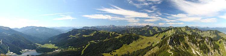
The Stümpfling is a mountain, 1,506 metres high, in the Bavarian Prealps. The mountain is an easy mountain walk from the Spitzingsee lake or from the Wildbach Hut. The Suttenbahn and Stümpflingbahn lifts run up the mountain to just below the summit.
External links
This article is issued from
Wikipedia.
The text is licensed under Creative Commons - Attribution - Sharealike.
Additional terms may apply for the media files.