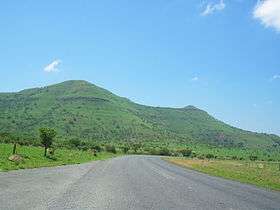
Spion Kop (mountain)
| Spion Kop | |
|---|---|
| Spioenkop | |
 | |
| Highest point | |
| Elevation | 1,460 m (4,790 ft) [1] |
| Listing | List of mountains in South Africa |
| Coordinates | 28°39′0″S 29°30′59″E / 28.65000°S 29.51639°ECoordinates: 28°39′0″S 29°30′59″E / 28.65000°S 29.51639°E |
| Geography | |
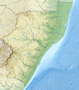 Spion Kop Location in KwaZulu-Natal | |
| Location | KwaZulu-Natal |
| Parent range | Drakensberg |
| Climbing | |
| First ascent | Unknown |
Spion Kop (Afrikaans: Spioenkop) is a mountain in the province of KwaZulu-Natal, South Africa. It is located near the town of Ladysmith, 27 km to the WSW and about 2.5 km to the north of the Spioenkop Dam, a reservoir for the waters of the Tugela River.
History
This mountain has historical significance. Its hilltop was the site of the Battle of Spion Kop (one of the most important battles of the Boer Wars) from 23 to 24 January 1900.[2] near the Tugela River, Natal in South Africa
Spion Kop Nature Reserve is located beneath the southern side of this mountain.[3]
See also
References
- ↑ Google Earth
- ↑ Oliver Ransford (1971). Battle Of Spion Kop. London: John Murray.
- ↑ Spion Kop Nature Reserve
External links
| Wikimedia Commons has media related to Spioenkop. |
This article is issued from
Wikipedia.
The text is licensed under Creative Commons - Attribution - Sharealike.
Additional terms may apply for the media files.