South Hills Junction station (PAAC)
South Hills Junction | |||||||||||||||||||||||||||||||||||||||||||
|---|---|---|---|---|---|---|---|---|---|---|---|---|---|---|---|---|---|---|---|---|---|---|---|---|---|---|---|---|---|---|---|---|---|---|---|---|---|---|---|---|---|---|---|
|
| |||||||||||||||||||||||||||||||||||||||||||
.jpg) | |||||||||||||||||||||||||||||||||||||||||||
| Location |
Boggston & Warrington Avenue Pittsburgh, Pennsylvania | ||||||||||||||||||||||||||||||||||||||||||
| Coordinates | 40°25′15″N 80°00′26″W / 40.4209°N 80.0073°WCoordinates: 40°25′15″N 80°00′26″W / 40.4209°N 80.0073°W | ||||||||||||||||||||||||||||||||||||||||||
| Owned by | Port Authority | ||||||||||||||||||||||||||||||||||||||||||
| Line(s) | |||||||||||||||||||||||||||||||||||||||||||
| Platforms | 4 | ||||||||||||||||||||||||||||||||||||||||||
| Connections | Port Authority bus routes 41, 41D, 40, 43, Y45, 48, 54C, Y1, Y46 and Y49; Washington City Transit Commuter Route | ||||||||||||||||||||||||||||||||||||||||||
| Construction | |||||||||||||||||||||||||||||||||||||||||||
| Disabled access | Yes | ||||||||||||||||||||||||||||||||||||||||||
| History | |||||||||||||||||||||||||||||||||||||||||||
| Opened | December 4, 1904 | ||||||||||||||||||||||||||||||||||||||||||
| Services | |||||||||||||||||||||||||||||||||||||||||||
| |||||||||||||||||||||||||||||||||||||||||||
| Location | |||||||||||||||||||||||||||||||||||||||||||
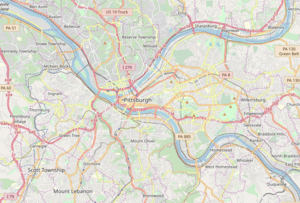 | |||||||||||||||||||||||||||||||||||||||||||
South Hills Junction is a station on the Port Authority of Allegheny County's light rail network.[1] This station served as the original "merge point" of the inbound Beechview and Overbrook branches of the light rail system, just before the run under Mount Washington through the Mount Washington Transit Tunnel and into downtown Pittsburgh. In 1993 the Overbrook (Blue) Line was shut down for complete reconstruction to serve the modern-day light rail cars.[2] During construction, it was found that a segment of track between the Boggs Ave. stop and South Hills Junction was too narrow for the larger vehicles; this was bypassed with two wide-curved rail ramps built between the Beechview (Red) Line's Palm Garden stop and South Hills Junction where the two branches now merge.
Few local residences are accessible from the station, which functions as a large transit center. In addition to serving as a transfer station for The T, a large number of bus connections are established at the site, including those that travel the South Busway, which travels on the upper level of the station.
History
The station and line were originally established by Pittsburgh Railways in 1904 when the Mount Washington Trolley Tunnel was completed, with the first fare paying passengers on December 4, 1904.[3]
Bus connections
- 41 Bower Hill
- 39 Brookline
- 40 Mt. Washington
- 43 Bailey
- Y45 Baldwin Manor Flyer
- 44 Knoxville
- 48 Arlington
- 54 North Side-Oakland-South Side
- Y1 Large Flyer
- Y46 Elizabeth Flyer
- Y47 Curry Flyer
- Y49 Prospect Park Flyer
- Washington City Transit Commuter Route
References
- ↑ Official Port Authority information page
- ↑ "Notes on the PAT Light Rail Lines". www.columbia.edu. Retrieved 2018-01-24.
- ↑ "First passengers carried through Tunnel". Pittsburg Press. April 15, 1958. Retrieved February 16, 2010.
External links
| Wikimedia Commons has media related to South Hills Junction. |