Someșul Mic River
| Someșul Mic River | |
| River | |
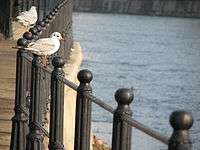
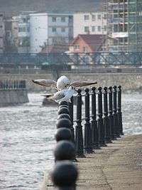 Banks of Someșul Mic river in Cluj-Napoca | |
| Countries | Romania |
|---|---|
| Counties | Cluj County |
| Tributaries | |
| - left | Someșul Cald, Nadăș |
| - right | Someșul Rece, Fizeș |
| Towns | Cluj-Napoca, Gherla, Dej |
| Source | Confluence of the Someșul Rece and Someșul Cald |
| - location | Gilău |
| Mouth | Someș |
| - location | near Dej |
| - coordinates | 47°8′41″N 23°54′48″E / 47.14472°N 23.91333°ECoordinates: 47°8′41″N 23°54′48″E / 47.14472°N 23.91333°E |
| Length | 178 km (111 mi) |
| Basin | 3,773 km2 (1,457 sq mi) |
| Progression | Someș→ Tisza→ Danube→ Black Sea |
The Someșul Mic River (Little Someș, Hungarian: Kis-Szamos) is a river in north-western Romania (Cluj County). Its total length is 178 km (111 mi), and its drainage basin area is 3,773 km2 (1,457 sq mi).[1] It is formed at the confluence of two headwaters, Someșul Cald ("Warm Someș") and Someșul Rece ("Cold Someș"), that come from the Apuseni Mountains. From the confluence, in Gilău, the Someșul Mic flows east and north through Cluj-Napoca, Apahida and Gherla, until it meets the Someșul Mare in Dej. Downstream from Dej, the river is called Someș.
Towns and villages
The following towns and villages are situated along the river Someșul Mic, from source to mouth: Gilău, Luna de Sus, Florești, Gârbău, Cluj-Napoca, Sânnicoară, Apahida, Jucu de Mijloc, Jucu de Sus, Răscruci, Bonțida, Fundătura, Iclozel, Livada, Hășdate, Gherla, Mintiu Gherlii, Petrești, Salatiu, Mănăstirea, Mica.
Tributaries
The following rivers are tributaries to the river Someșul Mic:
References
External links
| Wikimedia Commons has media related to Someșul Mic. |