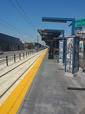
Snelling Avenue station
Snelling Avenue | |||||||||||
|---|---|---|---|---|---|---|---|---|---|---|---|
 The west half of Snelling Avenue | |||||||||||
| Coordinates | 44°57′20.48″N 93°10′1.17″W / 44.9556889°N 93.1669917°WCoordinates: 44°57′20.48″N 93°10′1.17″W / 44.9556889°N 93.1669917°W | ||||||||||
| Owned by | Metro Transit | ||||||||||
| Line(s) | |||||||||||
| Platforms | Split side platforms | ||||||||||
| Connections | A Line, 16, 21, 84[1] | ||||||||||
| Construction | |||||||||||
| Disabled access | Yes | ||||||||||
| History | |||||||||||
| Opened | June 14, 2014 | ||||||||||
| Traffic | |||||||||||
| Passengers (projected 2030) | 2,540 per weekday[1] | ||||||||||
| Services | |||||||||||
| |||||||||||
Snelling Avenue is a light rail station along the METRO Green Line in Saint Paul, Minnesota. It is located along University Avenue on either side of the intersection with Snelling Avenue. The station has split side platforms, with the westbound platform on the north side of the tracks west of Snelling and the eastbound platform on the south side of the tracks east of the intersection.[2]
This station serves the Snelling and University Avenues intersection. The Minnesota Department of Transportation counts 48,550 average daily motor vehicle volume, which is not in the 25 most-trafficked intersections in Minnesota.[3] But urban historian Larry Millett calculated around 64,000 daily cars; he believes that Snelling and University is the busiest in the state.[4]
Construction in this area began in 2011.[5] The station opened along with the rest of the line in 2014.
A bus rapid transit line, called the A Line, began operating on Snelling Avenue in June 2016, stopping at the station midway between its route from 46th Street to Rosedale Transit Center.[6]
Allianz Field will open in 2019 on the southeast corner of University and Snelling Avenues. The Snelling Avenue light rail station will serve the new soccer stadium.[7]
References
- 1 2 "Snelling Avenue Station". Central Corridor. Metropolitan Council. Archived from the original on October 24, 2011. Retrieved November 10, 2011.
- ↑ "Central Corridor light rail illustrated plans". Central Corridor. Metropolitan Council. June 28, 2010. Archived from the original on September 7, 2010. Retrieved September 16, 2010.
- ↑ "Minnesota's 10 Busiest Intersections". streets.mn. 2015-05-18. Retrieved 2018-04-20.
- ↑ Millett, Larry (2007). AIA Guide to the Twin Cities: The Essential Source on the Architecture of Minneapolis and St. Paul. Minnesota Historical Society Press, p. 502, 505. ISBN 0-87351-540-4
- ↑ "Central Corridor LRT construction schedule at a glance". Central Corridor. Metropolitan Council. July 20, 2010. Archived from the original on September 24, 2010. Retrieved September 16, 2010.
- ↑ Moore, Janet (June 10, 2016). "Rapid buses begin rolling Saturday on St. Paul's Snelling Avenue". Star Tribune. Retrieved June 18, 2016.
- ↑ Melo, Frederick (February 18, 2016). "Midway-Snelling site plan outlines movie theater, hotel, stadium, park plaza". Pioneer Press. Retrieved February 18, 2016.
External links