Cinajara
| Cinajara | |
|---|---|
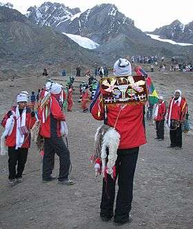 Quyllur Rit'i festival at the foothills of Cinajara and Jolljepunco | |
| Highest point | |
| Elevation | 5,471 m (17,949 ft) |
| Coordinates | 13°31′42″S 71°14′01″W / 13.52833°S 71.23361°WCoordinates: 13°31′42″S 71°14′01″W / 13.52833°S 71.23361°W [1] |
| Geography | |
 Cinajara Peru | |
| Location | Peru, Cusco Region |
| Parent range | Andes, Vilcanota |
| Climbing | |
| First ascent | 1-1979 via S.E. ridge.[2] |
Cinajara[1][3] or Sinaqara[4][5] is a mountain in the Vilcanota mountain range in the Andes of Peru, about 5,471 metres (17,949 ft) high.[1] It is situated in the Cusco Region, Quispicanchi Province, in the districts Ccarhuayo and Ocongate.[6] Cinajara lies southwest of the Jolljepunco. The annual religious Quyllur Rit'i festival takes place at the foot of the mountains Cinajara and Jolljepunco.[3]
References
- 1 2 3 Peru 1:100 000, Ocongate (28-t). IGN (Instituto Geográfico Nacional - Perú).
- ↑ Jill Neate, Mountaineering in the Andes, Peru: "Cinajara 5471m, P.5310m: N. of Ocongate: 1-1979 via S.E. ridge."
- 1 2 Busch, Oskar E. (2001). Peru für Trekker und Bergsteiger: 56 Wanderungen und 11 Bergbesteigungen in den peruanischen Anden (in German). Bergverlag Rother GmbH. p. 263. ISBN 9783763327058.
- ↑ La civilización andina: nuevo enfoque científico, filosófico y tecnológico (in Spanish). Academia Mayor de la Lengua Quechua. 2006. p. 119.
- ↑ Millones, Luis; Ōnuki, Yoshio (1994). El mundo ceremonial andino (in Spanish). Editorial Horizonte. p. 303.
- ↑ escale.minedu.gob.pe - UGEL map of the Quispicanchi Province 1 (Cusco Region) showing "Nevado Cinajara"
This article is issued from
Wikipedia.
The text is licensed under Creative Commons - Attribution - Sharealike.
Additional terms may apply for the media files.