Sierra Mágina
| Sierra Mágina | |
|---|---|
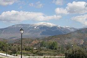 The Pico Almadén, seen from Arbuniel | |
| Highest point | |
| Peak | Pico Mágina |
| Elevation | 2,167 m (7,110 ft) |
| Coordinates | 37°43′N 3°28′W / 37.717°N 3.467°WCoordinates: 37°43′N 3°28′W / 37.717°N 3.467°W |
| Geography | |
 Sierra Mágina Location in Spain | |
| Location |
Granada province and Jaén province Andalusia |
| Parent range | Cordillera Subbética |
| Geology | |
| Mountain type | Limestone |
The Sierra Mágina is a massif mostly in the province of Jaén (southern Spain), part of the Cordillera Subbética. The highest peak is the Pico Mágina, with an elevation of 2,164 m.
Geography
The boundaries of the massif are grossly defined by the Guadalquivir valley from the north, the Guardiana Menor from east, and Guadahortuna from south and the Guadalbullón from south.
Protected area
Most of the chain is included in a natural park, the Parque Natural de Sierra Mágina.[1]
The range can be reached from Albanchez de Mágina, Bedmar, Belmez de la Moraleda, Cambil, Huelma, Jimena, Jódar, Mancha Real, Pegalajar or Torres
See also
- Baetic System
- Sierra Mágina Comarca
References
External links
| Wikimedia Commons has media related to Sierra Mágina. |
This article is issued from
Wikipedia.
The text is licensed under Creative Commons - Attribution - Sharealike.
Additional terms may apply for the media files.