Sierra de la Culata
| Sierra de La Culata | |
|---|---|
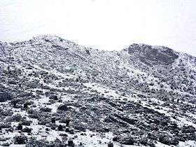 Sierra de La Culata on snowy season | |
| Highest point | |
| Peak | Pico Piedras Blancas |
| Elevation | 4,737 m (15,541 ft) |
| Coordinates | 8°59′13″N 71°15′0″W / 8.98694°N 71.25000°WCoordinates: 8°59′13″N 71°15′0″W / 8.98694°N 71.25000°W |
| Geography | |
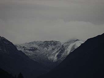
.jpg) Sierra de La Culata | |
| Country | Venezuela |
| State/Province | Mérida, Trujillo |
The Sierra de La Culata is a mountain range in the largest massif in Venezuela, the Cordillera de Mérida, which in turn is part of the northern extent of the Cordillera de los Andes (Andes Mountains). The Sierra la Culata includes some of the highest peaks in Venezuela, such as Pico Piedras Blancas, Pico Pan de Azúcar, and Collado del Cóndor.
It is located between the states of Mérida and Trujillo. Most of the lagoons are a result of the Mérida glaciation.
The Sierra La Culata National Park is a protected area within the range.
Gallery
.jpg)

See also
External links
This article is issued from
Wikipedia.
The text is licensed under Creative Commons - Attribution - Sharealike.
Additional terms may apply for the media files.