Sela, Trøndelag
| Sela | |
|---|---|
| Village | |
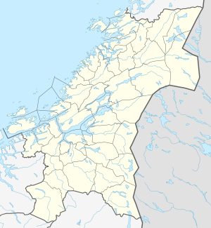
 Sela Location of the village  Sela Sela (Norway) | |
| Coordinates: 64°00′36″N 10°47′49″E / 64.0100°N 10.7970°ECoordinates: 64°00′36″N 10°47′49″E / 64.0100°N 10.7970°E | |
| Country | Norway |
| Region | Central Norway |
| County | Trøndelag |
| District | Innherred |
| Municipality | Verran |
| Elevation[1] | 277 m (909 ft) |
| Time zone | UTC+01:00 (CET) |
| • Summer (DST) | UTC+02:00 (CEST) |
| Post Code | 7796 Follafoss |
Sela is a village located in the municipality of Verran in Trøndelag county, Norway. It is located in the rural mountain area in the west-central part of Verran, very close to the municipal with Åfjord. The village sits along the shore of the lake Selavatnet, about 22 kilometres (14 mi) northwest of the village of Follafoss and about 29 kilometres (18 mi) west of the municipal center of Malm. The village is the location of Sela Church.
References
- ↑ "Sela, Verran (Trøndelag)". yr.no. Retrieved 2018-04-15.
This article is issued from
Wikipedia.
The text is licensed under Creative Commons - Attribution - Sharealike.
Additional terms may apply for the media files.