Sealer Hill

Sealer Hill is a hill rising to 91 m in the southwest part of Byers Peninsula, Livingston Island in the South Shetland Islands, Antarctica. It surmounts Nikopol Point and Sevar Point to the east-southeast and west-southwest, respectively. The area was inhabited by 19th century sealers.
The feature was so named following geological work by BAS in 1975-76, from the presence of at least three crude stone huts built by sealers below the hill.
Location
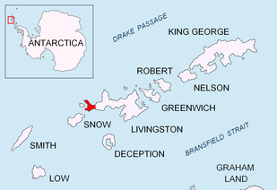
The hill is located at 62°40′09.7″S 61°06′52.1″W / 62.669361°S 61.114472°W, which is 1.28 km west-northwest of Nikopol Point, 1.83 km east-northeast of Sevar Point, 3.49 km east by north of Devils Point, 2.8 km southeast of Point Smellie, 4.07 km southwest of Basalt Lake and 3.96 km south-southwest of Chester Cone (British mapping in 1968, detailed Spanish mapping in 1992, and Bulgarian mapping in 2005 and 2009).
Maps
- Península Byers, Isla Livingston. Mapa topográfico a escala 1:25000. Madrid: Servicio Geográfico del Ejército, 1992.
- L.L. Ivanov et al. Antarctica: Livingston Island and Greenwich Island, South Shetland Islands. Scale 1:100000 topographic map. Sofia: Antarctic Place-names Commission of Bulgaria, 2005.
- L.L. Ivanov. Antarctica: Livingston Island and Greenwich, Robert, Snow and Smith Islands. Scale 1:120000 topographic map. Troyan: Manfred Wörner Foundation, 2009. ISBN 978-954-92032-6-4
References