Scroggins Draw, Reeves County, Texas
Scroggins Draw is a valley in Reeves County, Texas that is in the Fort Davis 79734 ZIP Code.[1] The topicgraphical features are:[2]
- Latitude: 31.0912495 North
- Longitude: -104.0524129 West
- Elevation: 3963 Feet above MSL
The location is notable for being the intersection between Interstate 10 and Interstate 20's terminus.
References
Municipalities and communities of Reeves County, Texas, United States | ||
|---|---|---|
| Cities | 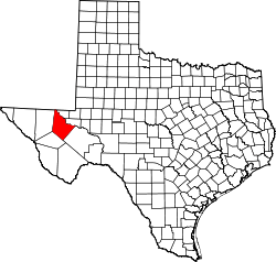 | |
| Town | ||
| CDP | ||
| Unincorporated communities | ||
| Ghost town | ||
This article is issued from
Wikipedia.
The text is licensed under Creative Commons - Attribution - Sharealike.
Additional terms may apply for the media files.