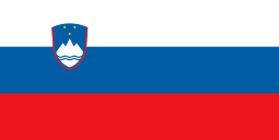
Savogna d'Isonzo
| Savogna d'Isonzo - Sovodnje ob Soči Sovodnje ob Soči | ||
|---|---|---|
| Comune | ||
| Comune di Savogna d'Isonzo - Občina Sovodnje ob Soči | ||
| ||
 Savogna d'Isonzo - Sovodnje ob Soči Location of Savogna d'Isonzo - Sovodnje ob Soči in Italy | ||
| Coordinates: 45°55′N 13°35′E / 45.917°N 13.583°E | ||
| Country | Italy | |
| Region | Friuli-Venezia Giulia | |
| Province | Gorizia (GO) | |
| Frazioni | Gabria-Gabrje, Peci-Peč, Rubbia-Rubije, Rupa, San Michele del Carso-Vrh sv. Mihaela | |
| Government | ||
| • Mayor | Alenka Florenin | |
| Area | ||
| • Total | 16.4 km2 (6.3 sq mi) | |
| Elevation | 235 m (771 ft) | |
| Population (2014[1][2]) | ||
| • Total | 1,744 | |
| • Density | 110/km2 (280/sq mi) | |
| Time zone | UTC+1 (CET) | |
| • Summer (DST) | UTC+2 (CEST) | |
| Postal code | 34070 | |
| Dialing code | 0481 | |
.jpg)
Ruins of the Roman bridge
Savogna d'Isonzo (Slovene: Sovodnje ob Soči; Friulian: Savogne di Gurize) is a comune (municipality) in the Province of Gorizia in the Italian region Friuli-Venezia Giulia, located about 35 kilometres (22 mi) northwest of Trieste and about 3 kilometres (1.9 mi) southwest of Gorizia, on the border with Slovenia. The name of the village comes from the Slovene word sovodnje, which means confluence. Near Savogna, in fact, the Vipava river flows into the Isonzo at the conjunction of the Karst Plateau and the Vipava Valley.
Ethnic composition
92% of the population was of Slovene ethnicity according to the Italian census of 1971.[3]
Main sights
- Church of San Martino, at Savogna
- Castle of Rubbia
- Church of San Nicolò, at Gabria
- Small square of Gabria
- Grotta Regina del Carso
Twin towns

References
- ↑ All demographics and other statistics: Italian statistical institute Istat.
- ↑ "Statistiche demografiche ISTAT". ISTAT. ISTAT. Retrieved March 25, 2015.
- ↑ Thomas, Lee; Lokar A. (1977) Socioeconomic structure of the Slovene population in Italy, Slovene Studies Journal, Chicago, Illinois, p.28.
See also
This article is issued from
Wikipedia.
The text is licensed under Creative Commons - Attribution - Sharealike.
Additional terms may apply for the media files.
