Savo Township, South Dakota
| Savo Township | |
|---|---|
| Township | |
 Savo Township | |
| Coordinates: 45°53′36″N 98°24′51″W / 45.89333°N 98.41417°WCoordinates: 45°53′36″N 98°24′51″W / 45.89333°N 98.41417°W | |
| Country | United States |
| State | South Dakota |
| County | Brown |
| Area[1] | |
| • Total | 35.573 sq mi (92.13 km2) |
| • Land | 35.567 sq mi (92.12 km2) |
| • Water | 0.006 sq mi (0.02 km2) |
| Elevation | 1,411 ft (430 m) |
| Population (2010) | |
| • Total | 71 |
| • Density | 2.0/sq mi (0.77/km2) |
| GNIS feature ID | 1268240[2] |
Savo Township is a township in Brown County, South Dakota, United States. As of the 2010 Census, it had a population of 71.[3]
References
- ↑ "US Gazetteer files: 2010, 2000, and 1990". United States Census Bureau. 2011-02-12. Retrieved 2011-04-23.
- ↑ "Township of Savo". Geographic Names Information System. United States Geological Survey.
- ↑ "American FactFinder". United States Census Bureau. Retrieved 2011-05-14.
Municipalities and communities of Brown County, South Dakota, United States | ||
|---|---|---|
| Cities | 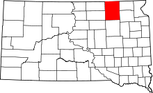 | |
| Towns | ||
| CDPs | ||
| Other unincorporated communities | ||
| Townships |
| |
| Footnotes | ‡This populated place also has portions in an adjacent county or counties | |
This article is issued from
Wikipedia.
The text is licensed under Creative Commons - Attribution - Sharealike.
Additional terms may apply for the media files.