Sarno (river)
| Sarno | |
|---|---|
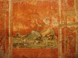 Personification of Sarno in Pompei | |
| Country | Italy |
| Physical characteristics | |
| Main source |
Above Sarno 30 m (98 ft) |
| River mouth | Bay of Naples, near Pompeii |
| Length | 24 km (15 mi) |
| Discharge |
|
| Basin features | |
| Basin size | 500 km2 (190 sq mi) |
The Sarno, known as Sarnus to the Romans, is a stream that passes through Pompeii to the south of the Italian city of Naples.[1] It is considered the most polluted river in Europe,[2] as a result of industrial waste. It flows about 24 kilometres (15 mi) from the base of Mt. Sarno to the Bay of Naples collecting water from the Solofrana and Cavaiola tributaries during the course of its flow.
It is still partially used for irrigation, as well as the transportation of goods and fishing. It is part of the Sarno river basin, which covers about 500 square kilometres (190 sq mi).[3]
The Sarno is the most polluted river in Italy due to the agricultural waste and waste water from the tanning factories around the town of Solofra.
There are about 500 small industries in the area which still pollute. Water treatment plants have been installed, however, they do not work to full capacity. The mouth of the river continues to make bathing in the sea impossible, despite numerous protests.
References
- ↑ Purcell, N., R. Talbert, S. Gillies, T. Elliott, J. Becker. "Places: 433102 (Sarnus (river))". Pleiades. Retrieved March 21, 2015.
- ↑ Water Pollution Facts
- ↑ Albanese, S; Iavazzo, P; Adamo, P; Lima, A; De Vivo, B. "Assessment of the environmental conditions of the Sarno river basin (south Italy): a stream sediment approach". Environ Geochem Health. 35: 283–97. doi:10.1007/s10653-012-9483-x. PMID 23053925.
External links
SOURCE: National Geospatial-Intelligence Agency, Bethesda, MD, USA
Coordinates: 40°44′N 14°28′E / 40.733°N 14.467°E