Sant'Angelo a Cupolo
| Sant'Angelo a Cupolo | |
|---|---|
| Comune | |
| Comune di Sant'Angelo a Cupolo | |
.svg.png) Sant'Angelo within the Province of Benevento | |
 Sant'Angelo a Cupolo Location of Sant'Angelo a Cupolo in Italy | |
| Coordinates: 41°4′N 14°48′E / 41.067°N 14.800°ECoordinates: 41°4′N 14°48′E / 41.067°N 14.800°E | |
| Country | Italy |
| Region | Campania |
| Province | Province of Benevento (BN) |
| Frazioni | Bagnara, Cardilli, Maccoli, Medina, Montorsi, Motta, Panelli, Pastene, Perrillo, San Marco ai Monti, Sciarra |
| Area | |
| • Total | 10.9 km2 (4.2 sq mi) |
| Population (Dec. 2004) | |
| • Total | 4,262 |
| • Density | 390/km2 (1,000/sq mi) |
| Time zone | UTC+1 (CET) |
| • Summer (DST) | UTC+2 (CEST) |
| Postal code | 82010 |
| Dialing code | 0824 |
Sant'Angelo a Cupolo is a comune (municipality) in the Province of Benevento in the Italian region Campania, located about 50 km northeast of Naples and about 8 km south of Benevento. As of 31 December 2004, it had a population of 4,262 and an area of 10.9 km².[1]
Geography
Sant'Angelo a Cupolo borders the following municipalities: Benevento, Ceppaloni, Chianche, San Leucio del Sannio, San Martino Sannita and San Nicola Manfredi. The municipality counts the hamlets (frazioni) of Bagnara, Cardilli, Maccoli, Medina, Montorsi, Motta, Panelli, Pastene, Perrillo, San Marco ai Monti and Sciarra.
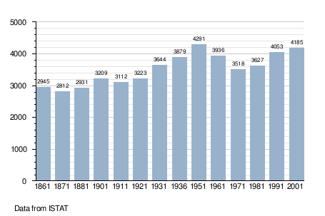
Demographics
See also
References
External links
![]()
This article is issued from
Wikipedia.
The text is licensed under Creative Commons - Attribution - Sharealike.
Additional terms may apply for the media files.