Saksahan
| Saksahan | |
| River | |
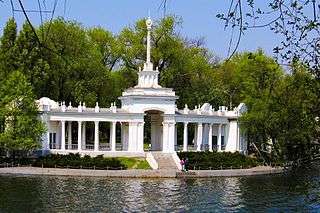 The Saksahan in Kryvyi Rih | |
| Country | Ukraine |
|---|---|
| Oblasts | Dnipropetrovsk |
| Towns/Cities | Kryvyi Rih |
| Source | |
| - coordinates | 48°15′41″N 34°06′08″E / 48.2613°N 34.1022°E |
| Mouth | Inhulets River |
| - coordinates | 47°32′06″N 33°11′45″E / 47.5351°N 33.1959°ECoordinates: 47°32′06″N 33°11′45″E / 47.5351°N 33.1959°E |
| Length | 144 km (89 mi) |
| Basin | 2,025 km2 (782 sq mi) |
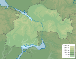 | |
Saksahan is a river in Ukraine, in the southeastern part of the Dnieper Upland, within Verhnedniprovsk, Pyatihatskoy, St. Sophia and the Kryvyi Rih districts of Dnepropetrovsk region. Left tributary of Inhulets (Dnieper basin).
The name is derived, according to some sources from the Turkic word «Saxagan» - «magpie».
The source of the river, in the modern territorial division, located by the village of Malooleksandrivka (Verkhnodniprovsk Raion), situated at an altitude of 140 meters above sea level.
The length of the river (river basin) 144 km (according to other sources has a total length of 130 kilometers), the width of the river bed in an average of 5 – 15 meters, plёsah places expands to 20 - 40 (29 to 40) meters (watershed line - 250 km).