Saint-Joseph Island
 Locator map of Saint-Joseph Island | |
| Geography | |
|---|---|
| Location | Atlantic Ocean |
| Coordinates | 5°16′53″N 52°34′54″W / 5.28139°N 52.58167°WCoordinates: 5°16′53″N 52°34′54″W / 5.28139°N 52.58167°W |
| Area | 20 ha (49 acres) |
| Highest elevation | 30 m (100 ft) |
| Administration | |
|
France | |
| Overseas department | French Guiana |
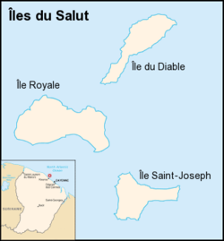
Saint Joseph Island, (French: Île Saint-Joseph) is the southernmost island of the three Salvation's Islands in the Atlantic Ocean off the coast of French Guiana. Twenty hectares in size, it is the middle in size. During the period when the islands were used as a penal colony, the island was reserved for solitary confinement. At an elevation of 30 meters, it is also the lowest island of the group. Most of the island is covered with dense vegetation.
This article is issued from
Wikipedia.
The text is licensed under Creative Commons - Attribution - Sharealike.
Additional terms may apply for the media files.