California State Route 25
| ||||
|---|---|---|---|---|
 SR 25 highlighted in red | ||||
| Route information | ||||
| Defined by Streets and Highways Code § 325 | ||||
| Maintained by Caltrans | ||||
| Length | 74.632 mi[1] (120.109 km) | |||
| Major junctions | ||||
| South end |
| |||
| North end |
| |||
| Location | ||||
| Counties | Monterey, San Benito, Santa Clara | |||
| Highway system | ||||
| ||||

State Route 25 (SR 25) is a state highway in the U.S. state of California between Gilroy and State Route 198.
Route description
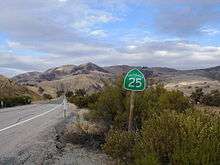
SR 25 (also known as Bolsa Road and the Airline Highway) begins at the intersection of Peach Tree Road and State Route 198 about 11 miles west of Priest Valley, in Monterey County, and is the northern extension of Peach Tree Road. It heads northwest, crossing into San Benito County and passing through the community of Bitterwater. SR 25 provides access to the Pinnacles National Park east entrance, running parallel to the San Andreas Fault.[2] Running parallel to the Gabilan Range and Diablo Range, SR 25 passes through the communities of Paicines and Tres Pinos before reaching the city of Hollister.
Upon reaching Hollister, the route turns into a four-lane undivided road, curving north and west through the east side of the city. North of Hollister, SR 25 reverts back into a 2-lane road and continues northwest from Hollister, intersecting with State Route 156. From there, the route is a partially divided road until just short of a railroad crossing and eventually crossing the Pajaro River into Santa Clara County. The route then heads northwest, and at the intersection with Bloomfield Avenue, the route then curves west before its northern terminus at U.S. Route 101 south of Gilroy.[3]
SR 25 is part of the California Freeway and Expressway System,[4] and a small portion near Hollister is part of the National Highway System,[5] a network of highways that are considered essential to the country's economy, defense, and mobility by the Federal Highway Administration.[6] SR 25 is eligible to be included in the State Scenic Highway System,[7] but it is not officially designated as a scenic highway by the California Department of Transportation.[8]
History
The Airline Highway Association was organized in 1933-4 and was composed of representatives of Alameda, Santa Clara, San Benito, Kern and Kings Counties. Its purpose was to establish this "Airline Highway".[9]
Major intersections
Except where prefixed with a letter, postmiles were measured on the road as it was in 1964, based on the alignment that existed at the time, and do not necessarily reflect current mileage. R reflects a realignment in the route since then, M indicates a second realignment, L refers an overlap due to a correction or change, and T indicates postmiles classified as temporary (for a full list of prefixes, see the list of postmile definitions).[1] Segments that remain unconstructed or have been relinquished to local control may be omitted. The numbers reset at county lines; the start and end postmiles in each county are given in the county column.
| County | Location | Postmile [1][10][11] | Destinations | Notes | |
|---|---|---|---|---|---|
| Monterey MON 0.00-11.75 | | 0.00 | South end of SR 25 | ||
| San Benito SBT 0.00-60.08 | Bitterwater | | King City (CR G13) | ||
| | 21.47 | ||||
| Paicines | 39.53 | ||||
| Hollister | 49.95 | Tres Pinos Road, Sunnyslope Road | Tres Pinos Road was former SR 25 north | ||
| L52.23 51.45 | Former SR 25 south / SR 156 | ||||
| | 54.05 | ||||
| Santa Clara SCL 0.00-2.56 | | | |||
| | 2.56 | Interchange; north end of SR 25 | |||
| 1.000 mi = 1.609 km; 1.000 km = 0.621 mi | |||||
See also

References
- 1 2 3 California Department of Transportation. "State Truck Route List". Sacramento: California Department of Transportation. Archived from the original (XLS file) on June 30, 2015. Retrieved June 30, 2015.
- ↑ The San Andreas Fault - III. Where Is It?
- ↑ The Road Atlas (Map). Rand McNally. 2009. p. 14. § SB4-SD5.
- ↑ California State Legislature. "Section 250–257". Streets and Highways Code. Sacramento: California State Legislature. Retrieved June 9, 2017.
- ↑ Federal Highway Administration (March 25, 2015). National Highway System: California (North) (PDF) (Map). Scale not given. Washington, DC: Federal Highway Administration. Retrieved October 18, 2017.
- ↑ Natzke, Stefan; Neathery, Mike & Adderly, Kevin (June 20, 2012). "What is the National Highway System?". National Highway System. Washington, DC: Federal Highway Administration. Retrieved July 1, 2012.
- ↑ California State Legislature. "Section 260–284". Streets and Highways Code. Sacramento: California State Legislature. Retrieved June 9, 2017.
- ↑ California Department of Transportation (September 7, 2011). "Officially Designated State Scenic Highways and Historic Parkways". Sacramento: California Department of Transportation. Retrieved October 18, 2017.
- ↑ Oakland Tribune article, Tues. June 19, 1934 page 5. "NEW AIRLINE, HIGHWAY TO L.A. PLANNED."
- ↑ California Department of Transportation (July 2007). "Log of Bridges on State Highways". Sacramento: California Department of Transportation.
- ↑ California Department of Transportation, All Traffic Volumes on CSHS, 2005 and 2006
External links
| Wikimedia Commons has media related to California State Route 25. |
Route map: