Rubkona
| Rubkona | |
|---|---|
| Town | |
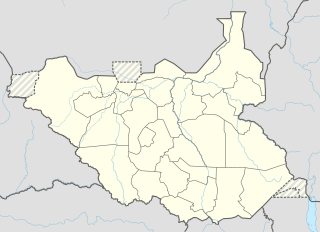 Rubkona Location in South Sudan | |
| Coordinates: 9°17′37″N 29°47′21″E / 9.293485°N 29.789198°ECoordinates: 9°17′37″N 29°47′21″E / 9.293485°N 29.789198°E | |
| Country |
|
| State | Unity State |
| County | Rubkona County |
| Elevation | 1,300 ft (400 m) |
| Population (2006 Estimate) | |
| • Total | 7,700 |
Rubkona (or Rub Kona, Rub-Koni) is a town in Unity State, South Sudan. It lies on the northern bank of the Bahr el Ghazal River, connected via El Salaam Bridge (The Peace Bride) to the state capital Bentiu.[1] This bridge was bombed by Sudanese Mig 29 bombers on Monday, April 23, 2012.[2] Rubkona is the administrative center of Rubkona County.[3]
During the Second Sudanese Civil War (1983-2005), conditions were extremely poor and dangerous. Refugees from the countryside moved to the town for greater safety.[4] After the peace agreement was signed in January 2005 there have been great improvements. The town now has a large market, and roads to the south are being greatly improved.[1] In the rainy season Rubkona is flooded. People must move from one part of town to another to escape the water.[4]
Bentiu Airport is located in Rubkona.
References
- 1 2 "Embattled South Sudan's Bentiu emerges from war". Sudan Tribune. 25 May 2006. Retrieved 2011-09-14.
- ↑ "Sudan MiGs bomb market in South Sudan". CBS News. April 23, 2012. Retrieved 2012-04-24.
- ↑ "Unity State Map" (PDF). UN OCHA. 08/03/10. Retrieved 2011-09-14. Check date values in:
|date=(help) - 1 2 "Sudan: ACF Nutrition survey - Preliminary results report, Rub Kona County, Unity State". Action Contre la Faim. 25 Aug 2008. Retrieved 2011-09-14.
External links
- "Rubkona Satellite Map - 1:7.000" (PDF). UN Sudan Information Gateway. Retrieved 2011-09-14.