Mangfall
| Mangfall | |
|---|---|
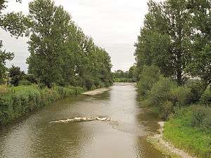
.JPG) Mangfall bend, looking downstream | |
| State | Bavaria, Germany |
| Reference no. | DE: 182 |
| Physical characteristics | |
| Main source |
Sources: tailstream of the Tegernsee 726 m above sea level (NN) 47°44′52″N 11°44′07″E / 47.74778°N 11.73528°ECoordinates: 47°44′52″N 11°44′07″E / 47.74778°N 11.73528°E |
| River mouth |
in Rosenheim into the Inn 444 m above sea level (NN) 47°51′35″N 12°08′10″E / 47.85972°N 12.13611°E |
| Length | 62.9 km (39.1 mi) [1] |
| Basin features | |
| Progression | Inn→ Danube→ Black Sea |
| Basin size | 1,098 km2 (424 sq mi) [1] |
| Landmarks |
|
| Tributaries |
|
| Waterbodies | Lakes: Tegernsee |
The Mangfall is a left tributary of the Inn in Upper Bavaria. It is 63 km long. The Mangfall is the outflow of the Tegernsee lake and discharges near Rosenheim into the Inn.
Towns and villages on the Mangfall
Sources
- Wernher Scheingraber, Martin Siepmann (Hrsg.): An Leitzach und Mangfall Bayerland, ISBN 3-89251-178-0
- Klaus J. Schönmetzler, Klaus G. Förg, Kurt Schubert (Hrsg.): Mangfalltal. Edition Förg, Rosenheim 2004, ISBN 3-933708-06-0
- Gerd Hedler, Wilhelm Albrecht, Gerd Lottes (Hrsg.): Leitzach und Mangfall, Christians, Hamburg 1983, ISBN 3-7672-0821-0
References
- 1 2 Complete table of the Bavarian Waterbody Register by the Bavarian State Office for the Environment (xls, 10.3 MB)
External links

- bike trail along the Mangfall
- Flux of the Mangfall in Rosenheim during the last 30 days
The Mangfall in Rosenheim
This article is issued from
Wikipedia.
The text is licensed under Creative Commons - Attribution - Sharealike.
Additional terms may apply for the media files.