River Maine (County Kerry)
| River Maine | |
|---|---|
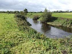 River Maine near Currans | |
| Native name | An Mhaing |
| Country | Ireland |
| Cities | Castlemaine, Currans, Castleisland |
| Physical characteristics | |
| Main source | Tobermaing, County Kerry |
| River mouth | Atlantic Ocean via Castlemaine Harbour |
| Length | 42.6 kilometres (26.5 mi) |
| Discharge |
|
| Basin features | |
| Basin size | 399 square kilometres (154 sq mi) |
| Tributaries |
|
The River Maine (Irish: An Mhaing[1]) is a river in County Kerry, Ireland.[2][3]
History and legend
According to an ancient tradition recorded in Lebor Gabála Érenn, three rivers "burst forth" during the reign of Fíachu Labrainne as High King of Ireland. One was Innbhear Mainge — the Maine. The Annals of the Four Masters contains the same story, but spells it Mand.
The Metrical Dindshenchas records Inber Cíchmaine, cid cress, gáet co líth-baile láech-bress Maine ergna, úais ella, mac Medba ocus Ailella. ("At Inber Cichmaine, though it be narrow, was slain (a mighty onslaught) far-famed Maine, son of Medb and Ailell, exulting in fury of warlike combats.")[4][5]
The Maine was the traditional division of the Kingdom of Desmond: south of the Maine was controlled by the Gaelic MacCarthys, while north of the Maine was controlled by the Norman Earl of Desmond.
Course
The River Maine rises at Tobermaing and flows westwards. It passes through Castleisland and under the N23, then meets its main tributary, the Brown Flesk. It continues through Currans and is bridged by the N22. In Castlemaine it passes under the N70, flows past the Ardcanaght Stones and enters the harbour.
Pollution
Wildlife
The River Maine is a noted salmon and sea trout fishery. The brook lamprey also lives in it.[7]
See also
References
- ↑ "An Mhaing/River Maine". logainm.ie.
- ↑ http://www.wfdfish.ie/wp-content/uploads/2009/09/Ballysadare.pdf
- ↑ http://www.epa.ie/licences/lic_eDMS/090151b280529f23.pdf
- ↑ "The Metrical Dindshenchas".
- ↑ "The Metrical Dindshenchas".
- ↑ "Experts attempt to trace sources of Kerry river pollution".
- ↑ "Brook lampreys spawning in the River Maine". Lamprey Surveys.
Coordinates: 52°13′42″N 9°19′42″W / 52.228373°N 9.328336°W