Golo (river)
| Golo | |
|---|---|
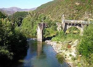 old Golo bridge near Castello-di-Rostino | |
| Country | France |
| Physical characteristics | |
| Main source | central Corsica |
| River mouth |
Tyrrhenian Sea 42°31′23″N 9°32′5″E / 42.52306°N 9.53472°ECoordinates: 42°31′23″N 9°32′5″E / 42.52306°N 9.53472°E |
| Length | 90 km (56 mi) |
The Golo is the longest (90 kilometres (56 mi)) river on the island of Corsica, France. Its source is in the mountainous middle of the island, south of Monte Cinto. It flows generally northeast, through Calacuccia and Ponte-Leccia, and ends in the Tyrrhenian Sea approximately 20 km south of Bastia, near the Bastia - Poretta Airport. Its entire course is in the Haute-Corse département.
References
This article is issued from
Wikipedia.
The text is licensed under Creative Commons - Attribution - Sharealike.
Additional terms may apply for the media files.