River Glass, Isle of Man
| River Glass | |
| River | |
| Country | Isle of Man |
|---|---|
| Tributaries | |
| - left | Injebreck River, Colder River |
| - right | Baldwin River, Sulby River |
| City | Douglas |
| Source | Injebreck Hill |
| - elevation | 270 m (886 ft) |
| - coordinates | 54°14′20″N 4°30′54″W / 54.239°N 4.515°W |
| Mouth | Confluence with River Dhoo |
| - coordinates | 54°09′04″N 4°30′07″W / 54.151°N 4.502°WCoordinates: 54°09′04″N 4°30′07″W / 54.151°N 4.502°W |
| Length | 11.5 km (7 mi) |
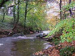
River Glass at Tromode
The River Glass is a river on the Isle of Man. The river begins in the area of Injebreck about 10 km north of Douglas, the Island's capital. Flowing down through the West Baldwin Valley, the river joins the River Dhoo to form the River Douglas on the outskirts of Douglas before flowing out to sea. The river has a length of appr. 8.5 km.
The name Glass originates from the word for green in Manx.
The western edge of the parish of Onchan is formed by the path of the Glass.
| Wikimedia Commons has media related to River Glass, Isle of Man. |
This article is issued from
Wikipedia.
The text is licensed under Creative Commons - Attribution - Sharealike.
Additional terms may apply for the media files.