Rinsennock
| Rinsennock | |
|---|---|
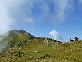 Hiking trail from Turracher Höhe to the Rinsennock summit | |
| Highest point | |
| Elevation | 2,334 m (7,657 ft) |
| Prominence | 435 m (1,427 ft) |
| Isolation | 6.3 kilometres (3.9 mi) |
| Coordinates | 46°54′32″N 13°51′2″E / 46.90889°N 13.85056°ECoordinates: 46°54′32″N 13°51′2″E / 46.90889°N 13.85056°E |
| Geography | |
 Rinsennock Location in the Alps | |
| Location |
Carinthia, Styria, Austria |
| Parent range |
Gurktal Alps Nock Mountains |
The Rinsennock is a mountain in the Gurktal Alps in Austria. It is part of the Nock Mountains sub-range and located at the border of the state of Carinthia with Upper Styria, immediately west of Turracher Höhe Pass. The summit, at 2,334 metres above the Adriatic (7,657 ft), is a popular destination for hikers.
References
This article is issued from
Wikipedia.
The text is licensed under Creative Commons - Attribution - Sharealike.
Additional terms may apply for the media files.