Riiser-Larsen Ice Shelf

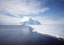
Riiser-Larsen Ice Shelf is an ice shelf about 250 miles (400 km) long on the coast of Queen Maud Land, extending from Cape Norvegia in the north to Lyddan Island and Stancomb-Wills Glacier in the south. Parts of the ice shelf were sighted by William Speirs Bruce in 1904, Ernest Shackleton in 1915, and Hjalmar Riiser-Larsen in 1930. Most of it was photographed from the air in 1951-52 by the Norwegian-British-Swedish Antarctic Expedition (NBSAE) and delineated from these photos. Additional delineation of the southern and landward margins of the feature was accomplished from air photos taken, by USN Operation Deep Freeze from 1967 to 1969. The feature was named by Norway for Capt. Hjalmar Riiser-Larsen, who explored the area in the late 1920s and early 1930s.
See also
Further reading
![]()
| Authority control |
|---|