ǀAi-ǀAis/Richtersveld Transfrontier Park
| ǀAi-ǀAis/Richtersveld Transfrontier Park | |
|---|---|
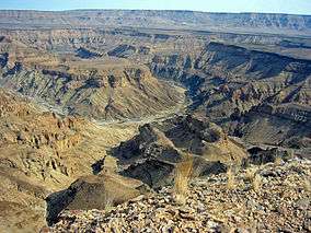 Fish River Canyon | |
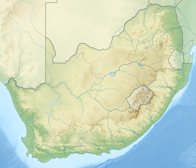 Location of the park | |
| Location |
ǁKaras Region Northern Cape |
| Nearest city |
Rosh Pinah, Namibia Alexander Bay, South Africa |
| Coordinates | 28°03′14″S 17°02′05″E / 28.05389°S 17.03472°ECoordinates: 28°03′14″S 17°02′05″E / 28.05389°S 17.03472°E |
| Area | 6,045 km2 (2,334 sq mi)[1] |
| Established | 2003 |
| Named for |
ǀAi-ǀAis Hot Springs Richtersveld |
| Governing body |
Ministry of Environment and Tourism (Namibia) South African National Parks |
| Official website | |
The ǀAi-ǀAis/Richtersveld Transfrontier Park is a peace park straddling the border between South Africa and Namibia. It was formed in 2003 by combining the Namibian ǀAi-ǀAis Hot Springs Game Park and the South African Richtersveld National Park. Most of the South African part of the park forms part of the buffer zone of the Richtersveld Cultural and Botanical Landscape World Heritage Site. The Fish River Canyon is located in the park.

Map of the park
See also
References
- ↑ "Ai-Ais/Richtersveld Transfrontier Park". PeaceParks.Org. Retrieved 2009-05-20.
External links
| Wikivoyage has a travel guide for Ai-Ais Richtersveld Transfrontier Park. |
| Wikimedia Commons has media related to ǀAi-ǀAis/Richtersveld Transfrontier Park. |
This article is issued from
Wikipedia.
The text is licensed under Creative Commons - Attribution - Sharealike.
Additional terms may apply for the media files.