Resculum (castra)
| Resculum | |
|---|---|
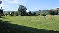
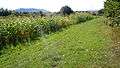
 View from South-East | |
 Location within Romania | |
| Known also as |
|
| Founded | 2nd century AD |
| Abandoned | c. 4th-5th century AD |
| Attested by | Tabula Peutingeriana |
| Place in the Roman world | |
| Province | Dacia |
| Administrative unit | Dacia Porolissensis |
| Administrative unit | Dacia Superior |
| Limes | Porolissensis |
| Directly connected to | |
| Structure | |
| — Stone structure — | |
| Size and area | 122 m × 213 m (2.6 [1] ha) |
| — Wood and earth structure — | |
| Size and area | 130 m × 203 m (2.6 [1] ha) |
| Stationed military units | |
| — Cohorts — | |
| |
| Location | |
| Coordinates | 46°53′08″N 22°53′05″E / 46.885694°N 22.884611°ECoordinates: 46°53′08″N 22°53′05″E / 46.885694°N 22.884611°E |
| Altitude | c. 527 m |
| Place name | Grădiște [3] |
| Town | Bologa |
| County | Cluj |
| Country |
|
| Reference | |
| RO-LMI | CJ-I-s-A-06975 [3] |
| RO-RAN | 59069.01 [3] |
| Site notes | |
| Recognition |
|
| Condition | Ruined |
| Excavation dates |
|
| Archaeologists | |
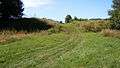
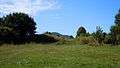
Resculum was a fort in the Roman province of Dacia.

See also
Notes
External links

- Castrul roman Bologa - reportaj sapaturi arheologice (in Romanian)
- Roman castra from Romania - Google Maps / Earth
This article is issued from
Wikipedia.
The text is licensed under Creative Commons - Attribution - Sharealike.
Additional terms may apply for the media files.