Renfrew (district)
| Renfrew Sgìre Rinn Friù | |
|---|---|
| Former local government district | |
 Renfrew District 1975-96 | |
| Coordinates: 55°50′N 4°30′W / 55.833°N 4.500°WCoordinates: 55°50′N 4°30′W / 55.833°N 4.500°W |
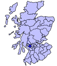
Renfrew District (Scottish Gaelic: Sgìre Rinn Friù) was one of nineteen local government districts in the Strathclyde region of Scotland, which existed between 1975 and 1996.
The district was formed by the Local Government (Scotland) Act 1973 from part of the former county of Renfrewshire, namely:
- The burghs of Barrhead, Johnstone, Paisley, and Renfrew
- The County of Renfrew Second, Third and Fourth Districts.
The remaining parts of the former County of Renfrew (Renfrewshire) where then divided between two other districts: Eastwood and Inverclyde.
In 1996 Renfrew District was abolished under the provisions of the Local Government etc. (Scotland) Act 1994. Most of its area became the unitary council area of Renfrewshire, with the regions - such as Strathclyde - disappearing entirely. Barrhead, Neilston and Uplawmoor were included in the council area of East Renfrewshire, which mainly consisted of the former Eastwood District.