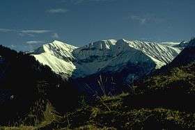
Rauheck
| Rauheck | |
|---|---|
 | |
| Highest point | |
| Elevation | 2,384 m (7,822 ft) |
| Prominence | 183 m (600 ft) |
| Isolation | 2.9 kilometres (1.8 mi) |
| Coordinates | 47°20′44″N 10°22′20″E / 47.34556°N 10.37222°ECoordinates: 47°20′44″N 10°22′20″E / 47.34556°N 10.37222°E |
| Geography | |
| Parent range | Allgäu Alps |

Climbing routes
Four paths lead to the summit:
- via the Oytal over the Älplesattel,
- via the Dietersbachtal, also over the Älplesattel,
- via the Eissee above the Käseralp
and
- via the Kreuzeck.
This article is issued from
Wikipedia.
The text is licensed under Creative Commons - Attribution - Sharealike.
Additional terms may apply for the media files.