Sherburn-in-Elmet Airfield
| Sherburn-in-Elmet Airfield | |||||||||||||||||||||||
|---|---|---|---|---|---|---|---|---|---|---|---|---|---|---|---|---|---|---|---|---|---|---|---|
 Proving ground | |||||||||||||||||||||||
| Summary | |||||||||||||||||||||||
| Airport type | Public | ||||||||||||||||||||||
| Operator | Sherburn Aero Club Ltd | ||||||||||||||||||||||
| Location | Sherburn-in-Elmet | ||||||||||||||||||||||
| Elevation AMSL | 26 ft / 8 m | ||||||||||||||||||||||
| Coordinates | 53°47′03″N 001°13′04″W / 53.78417°N 1.21778°WCoordinates: 53°47′03″N 001°13′04″W / 53.78417°N 1.21778°W | ||||||||||||||||||||||
| Website | www.sherburnaeroclub.com | ||||||||||||||||||||||
| Map | |||||||||||||||||||||||
 EGCJ Location in North Yorkshire | |||||||||||||||||||||||
| Runways | |||||||||||||||||||||||
| |||||||||||||||||||||||
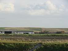
Sherburn-in-Elmet Airfield (ICAO: EGCJ) is located 1.5 nautical miles (2.8 km; 1.7 mi) east of Sherburn-in-Elmet village and 5.5 NM (10.2 km; 6.3 mi) west of Selby,[1] North Yorkshire, England.
Wartime history
During the Second World War it was used as a Royal Air Force station. From 1940 Blackburn Aircraft used a Ministry of Aircraft Production factory here to build 1699 Fairey Swordfish naval torpedo aircraft.
The Airborne Forces Experimental Establishment (AFEE) was moved from RAF Ringway to Sherburn on 17 June 1942. It was charged with developing the means to deploy allied airborne forces and supplies on operations by Military glider, Parachute and other means. The AFEE moved to RAF Beaulieu on 4 January 1945.
Post-war operations
Post-war, Sherburn has been used by private pilots and by aero clubs for training and leisure flying. The Yorkshire Aeroplane Club was based here for many years and organised several international air rallies in the early 1950s.
In addition to the listed runways, there is a closed/un-maintained 1,950-metre (6,400 ft) paved former runway parallel to, and about 95 metres (310 ft) northwest of, the current 06/24 grass runway.
References
External links
| Wikimedia Commons has media related to Sherburn in Elmet Airfield. |