Jatibonico del Sur River
| Jatibonico del Sur | |
|---|---|
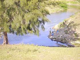 Fishermen at the Jatibonico del Sur. | |
| Countries | Cuba |
| Physical characteristics | |
| Main source |
Santa Clara 220 m (720 ft) 22°13′N 79°14′E / 22.217°N 79.233°E |
| River mouth |
Atlantic Ocean Jatibonico 0 m (0 ft) (Sea level) 21°33′N 79°09′E / 21.550°N 79.150°ECoordinates: 21°33′N 79°09′E / 21.550°N 79.150°E |
| Length | 119.5 km (74.3 mi) |
| Discharge |
|
Río Jatibonico del Sur is a river of southern Cuba.
The river's source is located approximately 1 kilometre south of the town Iguará at 220 metres of altitude. The water then splits into two streams, running down from the heights of the municipality of Santa Clara . The southern one is Río Jatibonico del Sur, while the northern one is Río Jatibonico del Norte. The river's mouth is located at the tip of Jatibonico in a low and marshy area, about 15 kilometers south of the town El Jíbaro. The river has a total length of 119.5 kilometres, constituting the border between the municipalities of Taguasco and Jatibonico, as well as the latter and La Sierpe.[1][2]
The water of the river is used for agriculture, especially rice plantations.[3]
See also
References
- ↑ Castro, Jose Ramon. "Pueblos de Cuba. Jatibonico: poblado de tradici-n azucarera y exquisita comida criolla". www.hicuba.com (in Spanish). Retrieved 2018-05-09.
- ↑ The Columbia Gazetteer of North America. 2000.
- ↑ "Jatibonico del Sur River Basin undergoes Renovation – Escambray". en.escambray.cu. 2016-07-22. Retrieved 2018-05-09.
This article is issued from
Wikipedia.
The text is licensed under Creative Commons - Attribution - Sharealike.
Additional terms may apply for the media files.