Puerto Obaldía
 Panama | |
| Location |
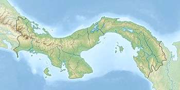
Puerto Obaldía Guna Yala Panama |
|---|---|
| Coordinates | 8°40′01.7″N 77°25′14.3″W / 8.667139°N 77.420639°W |
| Foundation | concrete base |
| Construction | metal skeletal tower |
| Tower shape | square pyramidal skeletal tower with balcony and light |
| Markings / pattern | white tower |
| Height | 12 metres (39 ft) |
| Focal height | 12 metres (39 ft) |
| Light source | solar power |
| Range | 8 nautical miles (15 km; 9.2 mi) |
| Characteristic | L Fl W 10s. |
| Admiralty number | J6143 |
| NGA number | 16630[1] [2] |
Puerto Obaldía is the smallest and easternmost of the four corregimientos of the Kuna Yala indigenous region of Panama, located on the border with Colombia. This mainland area that does not include any islands cannot be reached overland. It has an aerodrome. At the census of population of 2000, the number was 672, of which 533 resided in the main town of Puerto Obaldía. Other settlements werde La Miel (pop. 80), La Boca (pop. 31), and Playa Blanca (pop. 28).
See also
References
- ↑ Northern Panamá The Lighthouse Directory. University of North Carolina at Chapel Hill. Retrieved 23 January 2017
- ↑ List of Lights, Pub. 110: Greenland, The East Coasts of North and South America (Excluding Continental U.S.A. Except the East Coast of Florida) and the West Indies (PDF). List of Lights. United States National Geospatial-Intelligence Agency. 2016.
Coordinates: 8°39′N 77°24′W / 8.650°N 77.400°W
This article is issued from
Wikipedia.
The text is licensed under Creative Commons - Attribution - Sharealike.
Additional terms may apply for the media files.