Germán Olano Airport
| Germán Olano Airport Puerto Carreño Airport | |||||||||||
|---|---|---|---|---|---|---|---|---|---|---|---|
| Summary | |||||||||||
| Airport type | Public | ||||||||||
| Serves | Puerto Carreño, Colombia | ||||||||||
| Elevation AMSL | 173 ft / 53 m | ||||||||||
| Coordinates | 06°11′05″N 67°29′35″W / 6.18472°N 67.49306°W | ||||||||||
| Map | |||||||||||
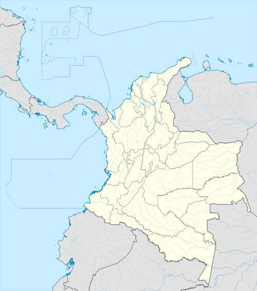
 PCR Location of airport in Colombia | |||||||||||
| Runways | |||||||||||
| |||||||||||
Germán Olano Airport (Spanish: Aeropuerto Germán Olano) (IATA: PCR, ICAO: SKPC) is an airport serving Puerto Carreño, the capital of Vichada Department in Colombia. It is also known as Puerto Carreño Airport (Aeropuerto Puerto Carreño). The airport is 1.5 kilometres (0.93 mi) west of and parallels the Orinoco River, locally Colombia's border with Venezuela.
The Puerto Carreno non-directional beacon (Ident: PCR) and VOR-DME (Ident: PTC) are located on the field.[4][5]
Airlines and destinations
| Airlines | Destinations |
|---|---|
| SATENA | Bogota, Villavicencio |
Accidents and incidents
- On December 20, 2016, Aerosucre Flight 4544 crashed while taking off from the airport after failing to become airborne. It was reported that 5 crew members died, and 1 crew member has several injuries.[6][7]
See also


- Transport in Colombia
- List of airports in Colombia
References
- ↑ "SKPC - PUERTO CARREÑO / German Olano" (PDF). (543 KB). AIP Colombia. Unidad Administrativa Especial de Aeronáutica Civil. 27 Aug 2009.
- ↑ Google Maps - Puerto Carreño
- ↑ Airport information for PCR at Great Circle Mapper.
- ↑ Puerto Carreno NDB
- ↑ Puerto Carreno VOR
- ↑ "Aerosucre Boeing 727-200 at Puerto Carrena on Dec 20th 2016, did not become airborne on takeoff". AeroInside. 21 December 2016. Retrieved 21 December 2016.
- ↑ "Vídeo: el momento en el que el avión de Aerosucre se estrella".
External links
This article is issued from
Wikipedia.
The text is licensed under Creative Commons - Attribution - Sharealike.
Additional terms may apply for the media files.