Pruzhany District
| Pruzhany District Пружанскі раён (Belarusian) Пружа́нский райо́н (Russian) | ||
|---|---|---|
| District | ||
| ||
 | ||
| Country |
| |
| Region |
| |
| Seat | Pruzhany | |
| Government | ||
| • Chairman | Mikhail Nikolayevich Kreydich[1] | |
| Area[2] | ||
| • District | 2,825.91 km2 (1,091.09 sq mi) | |
| Population (2017)[3] | ||
| • District | 47,340 | |
| • Density | 17/km2 (43/sq mi) | |
| • Urban | 23,297 | |
| • Rural | 24,043 | |
| Ethnic Composition[4] | ||
| • Belorusian | 87.49% | |
| • Russian | 6.43% | |
| • Ukrainian | 3.40% | |
| • Polish | 1.85% | |
| • Other | 0.83% | |
| Time zone | UTC+2 (EET) | |
| • Summer (DST) | UTC+3 (EEST) | |
| Area code(s) | 1632 | |
| Cities | 1 | |
| Rural Councils | 12 | |
| Settlements | 245 | |
| Website | Official website | |

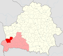
Pruzhany District or Pruzhanski Rayon Belarusian: Пружанскі раён, translit. Pružanski rajon; Russian: Пружа́нский райо́н, translit. Pruzhansky rayon; Polish: Prużański rejon) is district (raion) of Brest Region, in Belarus. Its administrative center is Pruzhany.[5]
Demographics
At the time of the Belarus Census (2009), Pruzhany Raion had a population of 52,511. Of these, 87.5% were of Belarusian, 6.4% Russian, 3.4% Ukrainian and 1.9% Polish ethnicity. 65.4% spoke Belarusian and 31.7% Russian as their native language.
Administrative Divisions
The district is subdivided into 1 city and 12 rural councils administering a total of 245 settlements (2 urban and 243 rural).[5]
| Name | Name (Belarusian) | Name (Russian) | Type | Settlements |
|---|---|---|---|---|
| Pruzhany | Пружаны | Пружаны | city of rayon subordinance | |
| Velikasyel'ski | Велікасельскі | Великосельский | rural council | 13 |
| Zyelyanyevitski | Зеляневіцкі | Зеленевичский | rural council | 24 |
| Linawski | Лінаўскі | Линовский | rural council | 26 |
| Mokrawski | Мокраўскі | Мокровский | rural council | 24 |
| Navazasimavitski | Навазасімавіцкі | Новозасимовичский | rural council | 1 |
| Pruzhanski | Пружанскі | Пружанский | rural council | 19 |
| Sukhopal'ski | Сухопальскі | Сухопольский | rural council | 28 |
| Kharawski | Хараўскі | Хоревской | rural council | 20 |
| Shanyawski | Шаняўскі | Шеневской | rural council | 19 |
| Shcharchowski | Шчарчоўскі | Щерчовский | rural council | 22 |
| Ruzhanski | Ружанскі | Ружанский | rural council | 33 |
| Sharashewski | Шарашэўскі | Шерешевский | rural council | 16 |
| Historical population | ||
|---|---|---|
| Year | Pop. | ±% |
| 1959 | 83,267 | — |
| 1970 | 79,399 | −4.6% |
| 1979 | 74,141 | −6.6% |
| 1989 | 68,492 | −7.6% |
| 1999 | 64,718 | −5.5% |
| 2009[4] | 52,211 | −19.3% |
| 2017[3] | 47,340 | −9.3% |
References
- ↑ "Chairman of the District Executive Committee". www.pruzhany.brest-region.gov.by (in Russian). Retrieved 2018-01-19.
- ↑ State Property Committee of the Republic of Belarus (1 Jan 2011). "State Land Cadastre of the Republic of Belarus". www.gki.gov.by (in Russian).
- 1 2 "Population as of 1 January 2017 and the average annual population in 2016 in the Republic of Belarus by regions, districts, cities, and townships". www.belstat.gov.by (in Russian). Retrieved 2018-01-16.
- 1 2 "Final census data of the population of the Republic of Belarus in 2009". census.belstat.gov.by. Retrieved 2018-01-17.
- 1 2 "STATEKARTGEOCENTER". www.maps.by. Retrieved 2018-01-17.
| Districts (raiony) |  | |
|---|---|---|
| Cities | ||
Coordinates: 52°33′32″N 24°28′09″E / 52.55889°N 24.46917°E
This article is issued from
Wikipedia.
The text is licensed under Creative Commons - Attribution - Sharealike.
Additional terms may apply for the media files.