Priest River
| Priest River | |
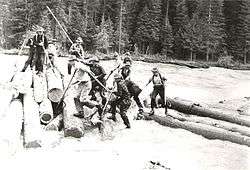 Log drivers on the Priest River | |
| Country | United States |
|---|---|
| State | Idaho |
| County | Bonner County, Idaho |
| Source | Upper Priest Lake |
| - elevation | 2,445 ft (745 m) [1] |
| - coordinates | 48°45′58″N 116°51′52″W / 48.76611°N 116.86444°W [2] |
| Mouth | Pend Oreille River |
| - location | near Priest River, Bonner County, Idaho |
| - elevation | 2,054 ft (626 m) [2] |
| - coordinates | 48°10′37″N 116°53′34″W / 48.17694°N 116.89278°WCoordinates: 48°10′37″N 116°53′34″W / 48.17694°N 116.89278°W [2] |
| Length | 68 mi (109 km) [3] |
| Basin | 980 sq mi (2,538 km2) [4] |
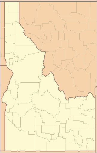 Location of the mouth of the Priest River in Idaho | |
The Priest River is a 68-mile (109 km) long[3] tributary of the Pend Oreille River in the U.S. state of Idaho. It is part of the Columbia River basin, as the Pend Oreille River is a tributary of the Columbia River. The river's drainage basin is 980 square miles (2,500 km2) in area.[4]
The river was named for a Roman Catholic priest, Father Roothaan.[5]
Course
The Priest River originates in Upper Priest Lake and flows south into Priest Lake. It exits the south end of Priest Lake and flows south to the Pend Oreille River near the city of Priest River.[2] The Upper Priest River, which is sometimes considered part of the Priest River proper, originates near the US-Canada border and flows south into Upper Priest Lake.[6]
Tributaries
The Priest River has three major tributaries. On the left, there is the East River. This river has about twenty tributaries itself, and flows into the Priest about 1 mile from Big Creek. On the right there is the Upper West Branch of the Priest River, and the Lower West Branch of the Priest River. These never merge. The Lower West Branch is more popular, this has Torelle Falls on it.
List;
- Indian creek
- Lion creek
- Hunt creek
- Soldier creek
- Quartz creek
- Upper west branch Priest River
- Lower west branch Priest River
- East River
- Big creek
- Blue creek
See also
References
- ↑ Source elevation derived from Google Earth search using GNIS source coordinates.
- 1 2 3 4 "Priest River". Geographic Names Information System. United States Geological Survey. June 21, 1979. Retrieved July 23, 2013.
- 1 2 "National Hydrography Dataset". United States Geological Survey. Retrieved July 15, 2013. Note: Length includes Priest Lake. The Priest River is 47 miles (76 km) long not including Priest Lake.
- 1 2 Intermountain Subbasin Plan, Pend Oreille, Northwest Power and Conservation Council
- ↑ Biennial Report of the Board of Trustees of the State Historical Society of Idaho. Idaho State Historical Society. 1922. p. 21.
- ↑ U.S. Geological Survey Geographic Names Information System: Upper Priest River