Poovaranthode
| Poovaranthode | |
|---|---|
| Coordinates: 11°23′11″N 76°04′25″E / 11.38639°N 76.07361°ECoordinates: 11°23′11″N 76°04′25″E / 11.38639°N 76.07361°E | |
| Country |
|
| State | Kerala |
| District | Kozhikode |
| Taluk | Thamarassery |
| Panchayat | Koodaranhi |
| Government | |
| • MP | M.I.Shanavas |
| • Panchayath President | Solly Joseph |
| • Panchayath Member | Sunny Perikilmtharappel |
| Languages | |
| • Official | Malayalam, English |
| Time zone | UTC+5:30 (IST) |
| PIN | 673604 |
| Vehicle registration | KL 57 |
Poovaranthode (Malayalam: പൂവാറൻതോട്) is a small village located in Kozhikode District, Kerala, India. As a hilltop village it is one of the coolest places in the Malabar region. Poovaranthode has a generally humid tropical climate with a very hot season extending from March to May. The average annual rainfall is more than 3500 mm, the highest in Kozhikode district. Hindus, Christians and Muslims co-exist in harmony. It is an agricultural area and a large portion of its population are farmers. Coconut and nutmeg are the major products.
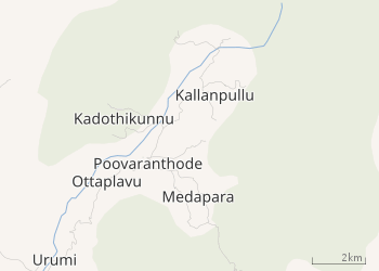
Location
Poovaranthode is situated at around 1,000 metres (3280.84 ft) above mean sea level in the Western Ghats mountain range. The place is about 48 km from Kozhikode city by road.The nearest airport is Calicut International Airport and the nearest railway station is Kozhikode railway station.
Etymology
The name Poovaranthode is believed to mean "Floating flowers in a ditch".
Landmarks
Poovaranthode contains GLP School, St. Mary's Curch, Juma masjid, Sree Udayagiri Dharmasasta Temple, Samskarika Nilayalm, Vayanashala, Sisumandhiram, and Vanasumrashana Samathi.
Demographics
Christians constitute a majority of the population, followed by Muslim and Hindu communities. The majority of the inhabitants are descendants of migrants from the Southern districts of Kerala (Mid-Travancore).
Transportation
KSRTC bus service is available for transportation to Kozhikode and Thiruvambady.
 |