Point of beginning
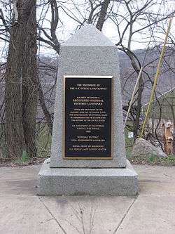
Marker for the Beginning Point of the U.S. Public Land Survey
The point of beginning is a surveyor's mark at the beginning location for the wide-scale surveying of land.
An example is the Beginning Point of the U.S. Public Land Survey that led to the opening of the Northwest Territory, and is the starting point of the surveys of almost all other lands to the west, reaching all the way to the Pacific Ocean.[1] On September 30, 1785, Thomas Hutchins, first and only Geographer of the United States,[2] began surveying the Seven Ranges at the point of beginning.[3]
Points of beginning
References
- ↑ "Beginning Point of the U.S. Public Land Survey". National Historic Landmark summary listing. National Park Service. Archived from the original on 2007-10-23. Retrieved 2007-11-08.
- ↑ Fort Steuben History
- ↑ Witcher, T. R. (July–August 2018). "Setting the Boundaries: The Point of Beginning Survey" (PDF). Civil Engineering. Reston, Va.: American Society of Civil Engineers. Retrieved August 4, 2018.
This article is issued from
Wikipedia.
The text is licensed under Creative Commons - Attribution - Sharealike.
Additional terms may apply for the media files.