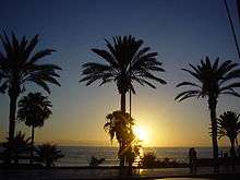
Playa de las Américas
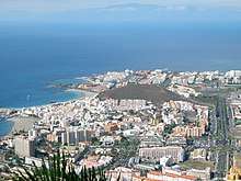
Playa de las Américas is a purpose-built holiday resort in the southern and southern-west part of the Municipality of Arona, close to the adjoining Municipality of Adeje in the west of Tenerife, one of the Canary Islands. It was built in the 1960s beside the town of Los Cristianos and stretching west to the Costa Adeje. The resort area features bars, nightclubs, restaurants, attractions, and beaches, most of which are man-made with imported sand from Africa due to the darkness of the native volcanic sand. Playa de las Americas is a centre of nightlife in Tenerife. Nightlife is spread around the resort and includes the Veronicas Strip, Starco Commercial Centre and the Patch.
Places of interest
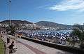
Beaches
There are five main beaches.
Playa de El Bobo
This beach is found at the foot of H10 Gran Tinerfe hotel. This is the most northern beach of Playa de las Américas.[1]
Playa de Troya
Protected by breakwaters, Playa de Troya beach allows for fun in the water without high waves.[1] This beach is located near Ravine of Troy (Spanish: Barranco de Troya).
Playa de las Américas
Playa de las Américas is an exposed beach and reef break that has reliable surf, although summer tends to be mostly flat.[1]
Playa Honda
Amazing melocactuses grow on the flower beds near Playa Honda beach.[1]
Playa del Camisón
Playa del Camisón is the most southern beach of Playa de las Américas.
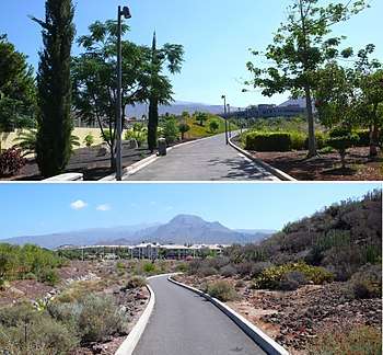
Central Park of Arona
The Central Park of Arona, or Parque Central de Arona, is a public park of 42,000 square metres. It has several squares, playgrounds and parking areas and a collection of tropical and Canarian plants.
It is located in the centre of Playa de las Americas beside the football stadium. It is bordered by colleges, court, a hospital, and residential buildings.
References
- 1 2 3 4 "Photographs of Playa de las Américas, August 2016". Independent Travellers. independent-travellers.com. Retrieved July 17, 2017.
External links
| Wikimedia Commons has media related to Playa de las Américas. |
| Wikivoyage has a travel guide for Playa de las Américas. |
- Arona.org General information site in English and Spanish
- Playa de las Américas -beaches World Travel Guide
Coordinates: 28°3′24.63″N 16°43′48.19″W / 28.0568417°N 16.7300528°W