Pitze
| Pitze or Pitzbach | |
|---|---|
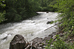 Pitze in Arzl im Pitztal | |
| Physical characteristics | |
| Main source | Tyrol, Austria |
| River mouth |
Inn 700 m (2,300 ft) 47°12′48″N 10°46′47″E / 47.2134°N 10.7797°ECoordinates: 47°12′48″N 10°46′47″E / 47.2134°N 10.7797°E |
| Length | 41 km (25 mi) [1] |
| Basin features | |
| Progression | Inn→ Danube→ Black Sea |
| Basin size | 308 km2 (119 sq mi) [1] |
The Pitze (also: Pitzbach) is a right tributary of the river Inn in the Imst (district) and flows through the Pitztal, a southern valley of the Inntal. It has a length of about 41 kilometres (25 mi), and its basin area is 308 km2 (119 sq mi).[1] It merges with the Inn 3 kilometres (1.9 mi) east of the city of Imst at an elevation of 700 metres (2,300 ft).
References
This article is issued from
Wikipedia.
The text is licensed under Creative Commons - Attribution - Sharealike.
Additional terms may apply for the media files.