Pic dels Aspres
| Pic dels Aspres | |
|---|---|
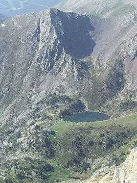 Pic del Aspres, Estany de les Truites and Refugi de Coma Pedrosa. | |
| Highest point | |
| Elevation | 2,562 m (8,406 ft) |
| Parent peak | Pic del Port Vell |
| Coordinates | 42°34′45″N 1°27′05″E / 42.57917°N 1.45139°ECoordinates: 42°34′45″N 1°27′05″E / 42.57917°N 1.45139°E |
| Geography | |
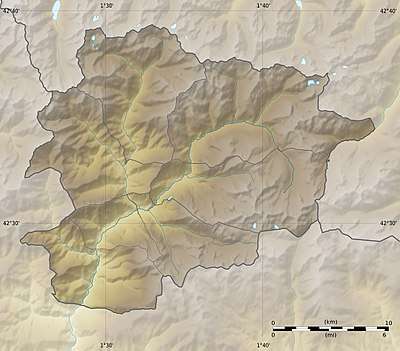 Pic dels Aspres Location of Pic dels Aspres within La Massana parish, Andorra | |
| Location | La Massana parish, Andorra |
| Parent range | Pyrenees |
Pic dels Aspres is a mountain in the northwest of the principality of Andorra, close to the border with Spain. The nearest town is Arinsal, La Massana. Some 250 metres below the summit is a round cirque, approximately 100 metres in diameter, which was formed by glacial erosion during the Last Glacial Maximum and which is now a lake, Estany de les Truites (the trout lake).
The valley to the south of the mountain is used as a ski area.
References
This article is issued from
Wikipedia.
The text is licensed under Creative Commons - Attribution - Sharealike.
Additional terms may apply for the media files.