Philip, South Dakota
| Philip, South Dakota | |
|---|---|
| City | |
 Haakon County Courthouse in Philip | |
| Motto(s): "Where The Sun Kisses The Earth" | |
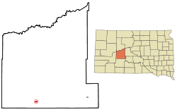 Location in Haakon County and the state of South Dakota | |
| Coordinates: 44°2′24″N 101°39′58″W / 44.04000°N 101.66611°WCoordinates: 44°2′24″N 101°39′58″W / 44.04000°N 101.66611°W | |
| Country | United States |
| State | South Dakota |
| County | Haakon |
| Founded | 1907[1] |
| Area[2] | |
| • Total | 0.60 sq mi (1.55 km2) |
| • Land | 0.60 sq mi (1.55 km2) |
| • Water | 0 sq mi (0 km2) |
| Elevation | 2,165 ft (660 m) |
| Population (2010)[3] | |
| • Total | 779 |
| • Estimate (2015)[4] | 751 |
| • Density | 1,298.3/sq mi (501.3/km2) |
| Time zone | UTC-7 (Mountain (MST)) |
| • Summer (DST) | UTC-6 (MDT) |
| ZIP code | 57567 |
| Area code(s) | 605 |
| FIPS code | 46-49300[5] |
| GNIS feature ID | 1257034[6] |
Philip is a town in, and county seat of, rural Haakon County, South Dakota, United States.[7] The population was 779 at the 2010 census.
History
Philip was laid out in 1907 when the Chicago and North Western Railway was extended to that point.[8] It was incorporated in 1908. In 1914, Philip was designated seat of the newly formed Haakon County.[9] The city was named for James "Scotty" Philip;[10] the local high school mascot is the Scotch terrier, or "Scottie", in his honor.
Economy
Agriculture is the primary industry in Philip. Businesses include two grain elevators, a livestock auction, veterinary clinic, and numerous other businesses providing goods and services related to the farms and ranches surrounding the community.
Philip is also home to Scotchman Industries, a manufacturer of metal fabrication machinery (hydraulic ironworkers, circular cold saws, band saws, tube & pipe notchers & measuring systems). The hospital and school are other major sources of employment within the community.
Geography
Philip is located at 44°2′24″N 101°39′58″W / 44.04000°N 101.66611°W (44.039949, −101.666208).[11]
According to the United States Census Bureau, the city has a total area of 0.60 square miles (1.55 km2), all of it land.[2]
Philip has been assigned the ZIP code 57567 and the FIPS place code 49300.
Philip is located on the banks of the Bad River, which empties into the Missouri River at Fort Pierre, S.D.
Climate
Philip has a USDA hardiness zone of 4b, with minimum temperatures ranging from -25 to -20 °F.[12]
| Climate data for Philip (2,165 feet above sea level) | |||||||||||||
|---|---|---|---|---|---|---|---|---|---|---|---|---|---|
| Month | Jan | Feb | Mar | Apr | May | Jun | Jul | Aug | Sep | Oct | Nov | Dec | Year |
| Record high °F (°C) | 74.0 (23.3) |
76.0 (24.4) |
87.0 (30.6) |
96.0 (35.6) |
105.0 (40.6) |
111.0 (43.9) |
111.0 (43.9) |
113.0 (45) |
107.0 (41.7) |
97.0 (36.1) |
84.0 (28.9) |
72.0 (22.2) |
113 (45) |
| Average high °F (°C) | 35.0 (1.7) |
39.0 (3.9) |
48.0 (8.9) |
60.0 (15.6) |
70.0 (21.1) |
81.0 (27.2) |
89.0 (31.7) |
89.0 (31.7) |
78.0 (25.6) |
63.0 (17.2) |
47.0 (8.3) |
36.0 (2.2) |
61 (16.3) |
| Daily mean °F (°C) | 22.5 (−5.3) |
26.0 (−3.3) |
35.0 (1.7) |
46.0 (7.8) |
57.0 (13.9) |
67.5 (19.7) |
74.5 (23.6) |
73.5 (23.1) |
62.5 (16.9) |
48.5 (9.2) |
34.0 (1.1) |
23.5 (−4.7) |
47.5 (8.6) |
| Average low °F (°C) | 10.0 (−12.2) |
13.0 (−10.6) |
22.0 (−5.6) |
32.0 (0) |
44.0 (6.7) |
54.0 (12.2) |
60.0 (15.6) |
58.0 (14.4) |
47.0 (8.3) |
34.0 (1.1) |
21.0 (−6.1) |
11.0 (−11.7) |
34 (1) |
| Record low °F (°C) | −35.0 (−37.2) |
−33.0 (−36.1) |
−29.0 (−33.9) |
5.0 (−15) |
16.0 (−8.9) |
32.0 (0) |
37.0 (2.8) |
32.0 (0) |
20.0 (−6.7) |
−3.0 (−19.4) |
−25.0 (−31.7) |
−32.0 (−35.6) |
−35 (−37.2) |
| Average precipitation inches (mm) | 0.30 (7.6) |
0.51 (13) |
1.27 (32.3) |
1.84 (46.7) |
3.03 (77) |
2.93 (74.4) |
2.03 (51.6) |
1.50 (38.1) |
1.49 (37.8) |
1.43 (36.3) |
0.62 (15.7) |
0.43 (10.9) |
17.38 (441.4) |
| Source: Weather Channel[13] | |||||||||||||
Demographics
| Historical population | |||
|---|---|---|---|
| Census | Pop. | %± | |
| 1910 | 578 | — | |
| 1920 | 647 | 11.9% | |
| 1930 | 786 | 21.5% | |
| 1940 | 833 | 6.0% | |
| 1950 | 810 | −2.8% | |
| 1960 | 1,114 | 37.5% | |
| 1970 | 983 | −11.8% | |
| 1980 | 1,088 | 10.7% | |
| 1990 | 1,077 | −1.0% | |
| 2000 | 885 | −17.8% | |
| 2010 | 779 | −12.0% | |
| Est. 2016 | 765 | [14] | −1.8% |
| U.S. Decennial Census[15] 2015 Estimate[4] | |||
2010 census
As of the census[3] of 2010, there were 779 people, 375 households, and 197 families residing in the city. The population density was 1,298.3 inhabitants per square mile (501.3/km2). There were 423 housing units at an average density of 705.0 per square mile (272.2/km2). The racial makeup of the city was 94.4% White, 0.3% African American, 2.2% Native American, 0.8% Asian, and 2.4% from two or more races. Hispanic or Latino of any race were 1.2% of the population.
There were 375 households of which 20.0% had children under the age of 18 living with them, 44.3% were married couples living together, 6.9% had a female householder with no husband present, 1.3% had a male householder with no wife present, and 47.5% were non-families. 44.8% of all households were made up of individuals and 24% had someone living alone who was 65 years of age or older. The average household size was 1.98 and the average family size was 2.79.
The median age in the city was 51.5 years. 19.1% of residents were under the age of 18; 4.4% were between the ages of 18 and 24; 18.7% were from 25 to 44; 30.3% were from 45 to 64; and 27.5% were 65 years of age or older. The gender makeup of the city was 45.8% male and 54.2% female.
2000 census
As of the census[5] of 2000, there were 885 people, 367 households, and 226 families residing in the city. The population density was 1,527.7 people per square mile (589.1/km²). There were 424 housing units at an average density of 731.9 per square mile (282.3/km²). The racial makeup of the city was 95.59% White, 3.16% Native American, 0.23% Asian, and 1.02% from two or more races. Hispanic or Latino of any race were 1.36% of the population.
There were 367 households out of which 29.2% had children under the age of 18 living with them, 54.0% were married couples living together, 5.4% had a female householder with no husband present, and 38.4% were non-families. 34.1% of all households were made up of individuals and 18.5% had someone living alone who was 65 years of age or older. The average household size was 2.28 and the average family size was 2.99.
In the city, the population was spread out with 23.1% under the age of 18, 8.6% from 18 to 24, 24.5% from 25 to 44, 20.0% from 45 to 64, and 23.8% who were 65 years of age or older. The median age was 42 years. For every 100 females, there were 85.5 males. For every 100 females age 18 and over, there were 84.6 males.
As of 2000 the median income for a household in the city was $31,103, and the median income for a family was $43,929. Males had a median income of $28,438 versus $18,977 for females. The per capita income for the city was $17,243. About 8.3% of families and 11.0% of the population were below the poverty line, including 17.1% of those under age 18 and 12.6% of those age 65 or over.
Notable natives
- Patrick Henry Brady – Medal of Honor recipient for service in the Vietnam War
- Lincoln McIlravy – bronze medalist in wrestling at the 2000 Summer Olympics
References
- ↑ "SD Towns" (PDF). South Dakota State Historical Society. Retrieved 2010-02-15.
- 1 2 "US Gazetteer files 2010". United States Census Bureau. Archived from the original on 2012-01-24. Retrieved 2012-06-21.
- 1 2 "American FactFinder". United States Census Bureau. Retrieved 2012-06-21.
- 1 2 "Population Estimates". United States Census Bureau. Archived from the original on October 19, 2016. Retrieved June 12, 2016.
- 1 2 "American FactFinder". United States Census Bureau. Retrieved 2008-01-31.
- ↑ "US Board on Geographic Names". United States Geological Survey. 2007-10-25. Retrieved 2008-01-31.
- ↑ "Find a County". National Association of Counties. Retrieved 2011-06-07.
- ↑ Federal Writers' Project (1940). South Dakota place-names, v.1–3. University of South Dakota. p. 56.
- ↑ Hellmann, Paul T. (May 13, 2013). "Historical Gazetteer of the United States". Routledge. p. 995. Retrieved November 30, 2013.
- ↑ Chicago and North Western Railway Company (1908). A History of the Origin of the Place Names Connected with the Chicago & North Western and Chicago, St. Paul, Minneapolis & Omaha Railways. p. 113.
- ↑ "US Gazetteer files: 2010, 2000, and 1990". United States Census Bureau. 2011-02-12. Retrieved 2011-04-23.
- ↑ "USDA Plant Hardiness Zone Map". usda.gov.
- ↑ "Philip, SD Monthly Weather Forecast". Weather Channel. Retrieved 11 May 2018.
- ↑ "Population and Housing Unit Estimates". Retrieved June 9, 2017.
- ↑ United States Census Bureau. "Census of Population and Housing". Retrieved June 12, 2016.
Municipalities and communities of Haakon County, South Dakota, United States | ||
|---|---|---|
| City |  | |
| Town | ||
| Unincorporated communities | ||
| Indian reservation | ||
| Ghost towns | ||
| Footnotes | ‡This populated place also has portions in an adjacent county or counties | |