Parish of Peppora
Peppora is a station in west New South Wales situated about 440km east-northeast of Adelaide, about 800km west of Sydney, New South Wales. Peppora is at an altitude of approximately 57m. Peppora is one of the westernmost homesteads in New South Wales. [1] Peppora Stations is the traditional land of the Barkindji people. [2]
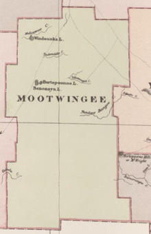
Mootwingee County from Johns Sands 1886 map.[3]
The civil parish of Peppora is located at 30°56′42″S 142°02′07″E. in Mootwingee County and is almost unpopulated, with less than two inhabitants per square kilometer.[4]The parish has a Köppen climate classification of BWh (Hot desert)[5].
References
- ↑ Peppora, NSW.
- ↑ History of Tolarno.
- ↑ from John Sands, Atlas of Australia 1886.
- ↑ NASA Earth Observations: Population Density”. NASA/SEDAC..
- ↑ Peel, M. C.; Finlayson, B. L.; McMahon, T. A. (2007). "Updated world map of the Köppen–Geiger climate classification". Hydrol. Earth Syst. Sci. 11: 1633–1644. doi:10.5194/hess-11-1633-2007. ISSN 1027-5606. (direct: Final Revised Paper)
This article is issued from
Wikipedia.
The text is licensed under Creative Commons - Attribution - Sharealike.
Additional terms may apply for the media files.