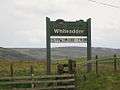
Whiteadder Reservoir
| Whiteadder Reservoir | |
|---|---|
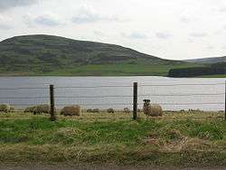 Sheep at the reservoir | |
| Location | East Lothian, Scotland |
| Coordinates | 55°51′50″N 2°33′23″W / 55.86389°N 2.55639°WCoordinates: 55°51′50″N 2°33′23″W / 55.86389°N 2.55639°W |
| Type | reservoir |
| Basin countries | United Kingdom |
| Surface area | 193 acres (0.78 km2) |
Whiteadder Reservoir is a reservoir in East Lothian, Scotland, UK, in the Lammermuir Hills, 11 miles (18 km) north west of Duns in the Scottish Borders, and five miles (8 km) south east of Garvald. It was created to provide additional water facilities for East Lothian.
Work on the Dam forming the reservoir commenced in 1964.[1] Design was carried out by consulting civil engineers GH Hill & Sons of Manchester and London, on behalf of the then local water authority - East Lothian Water Board. The flooding ceremony was in May 1968. Millknowe Farm and Kingside School were flooded.
Whiteadder reservoir supplies East Lothian and Berwickshire, including Cockenzie Power Station on the northern coast of East Lothian, the Whiteadder Water flows out of the reservoir and the lowest tributary of the River Tweed which it enters at Berwick-on-Tweed.
Data
Whiteadder Sailing Centre
Although the reservoir and the Outdoor Education Centre are in East Lothian, it has been managed by the Outdoor Education department of Scottish Borders Council for over 20 years. Through a partnership between East Lothian Council, Scottish Borders Council and Borders Sailing Club, funds were obtained for a major refurbishment, and the new Centre was opened in 2005.
Antiquities
_-_geograph.org.uk_-_103058.jpg)
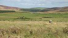
Prehistoric settlement in the area is represented by the Friar's Nose, a multivallate promontory fort immediately east of the reservoir.[2] Directly across the Whiteadder valley from the fort, to the north-east of the reservoir, traces of a prehistoric settlement and field system have been recorded.[3]
Penshiel Grange is a ruin located to the southeast of the reservoir. It was a monastic grange attached to Melrose Abbey, and was probably built in the first half of the 15th century, though there is reference to Penshiel in a charter of 1200.[4] Penshiel Grange is protected as a scheduled monument.[5] The main building measures about 82 by 25 feet (25.0 by 7.6 m), and has a wall about 10 feet (3.0 m) high. There are some traces of a tower at the south east corner, and some evidence of a courtyard to the north and south of the ruin, with the wall on the south of the main building now being merely a turf-covered stony bank. There were at least two building to the north, one of which may have been a chapel.[4]
The ruins of Gamelshiel Castle are located around 0.6 kilometres (0.37 mi) north-east of the northern end of the reservoir, on the south side of the Hall Burn. The lands of Gamelshiel were held by the Forrest family in the 16th century, and by the Homes in the 17th century.[6] The fragmentary ruin comprises the east and west walls of a small tower house, built in the 16th century.[7] The tower was constructed from whinstone and was around 7 metres (23 ft) across. The remaining walls are 1.3 metres (4 ft 3 in) thick and stand to a height of 6 metres (20 ft). The height and appearance of the tower is uncertain, though there is evidence of a vaulted cellar.[6]
To the west of the reservoir is the "Packman's Grave", a setting of stones said to mark the burial-place of a murdered packman.[8]
Photo gallery
 Whiteadder
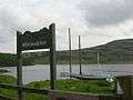 Sailing at Whiteadder
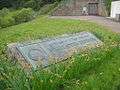 Reservoir Memorial plaque
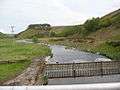 Whiteadder Water from the Reservoir
See also
References
- ↑ Baker, S, ed. (2012). "The Fourth Statistical Account of East Lothian". The Fourth Statistical Account of East Lothian. Retrieved 18 April 2018.
- ↑ "Friar's Nose". Canmore. Historic Environment Scotland. Retrieved 29 March 2017.
- ↑ "Gamelshiel, settlement & field system 950m ESE of. SM8769". Historic Environment Scotland. Retrieved 29 March 2017.
- 1 2 "Penshiel Grange". Canmore. Historic Environment Scotland. Retrieved 29 March 2017.
- ↑ "Penshiel Grange. SM6028". Historic Environment Scotland. Retrieved 29 March 2017.
- 1 2 "Gamelshiel". Canmore. Historic Environment Scotland. Retrieved 29 March 2017.
- ↑ "Gamelshiel Castle. SM5606". Historic Environment Scotland. Retrieved 29 March 2017.
- ↑ "Packman's Grave". Canmore. Historic Environment Scotland. Retrieved 29 March 2017.